You are here: Home > Network List > TA - USArray Transportable Network (new EarthScope stations) Stations List
> Station D28A Regan, ND, USA > Earthquake Result Viewer
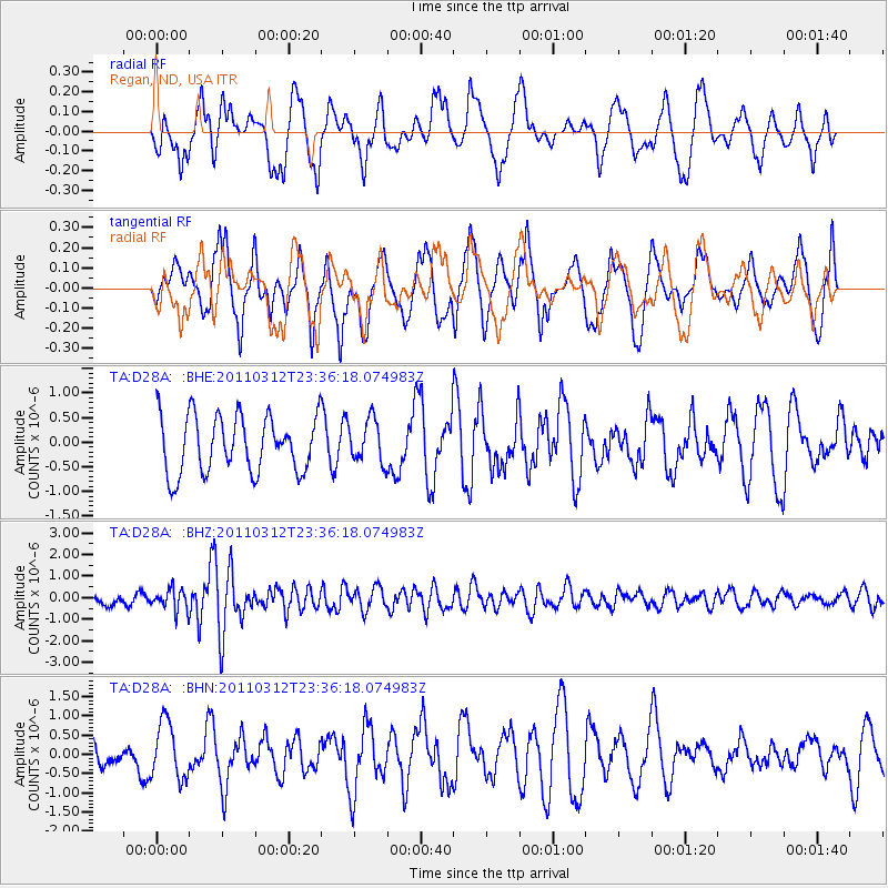
D28A Regan, ND, USA - Earthquake Result Viewer
*The percent match for this event was below the threshold and hence no stack was calculated.
| Earthquake location: |
Near East Coast Of Honshu, Japan |
| Earthquake latitude/longitude: |
38.0/141.7 |
| Earthquake time(UTC): |
2011/03/12 (071) 23:24:48 GMT |
| Earthquake Depth: |
15 km |
| Earthquake Magnitude: |
6.0 MB, 5.6 MS, 6.1 MW, 5.9 MW |
| Earthquake Catalog/Contributor: |
WHDF/NEIC |
|
| Network: |
TA USArray Transportable Network (new EarthScope stations) |
| Station: |
D28A Regan, ND, USA |
| Lat/Lon: |
47.19 N/100.57 W |
| Elevation: |
621 m |
|
| Distance: |
78.6 deg |
| Az: |
38.026 deg |
| Baz: |
314.508 deg |
| Ray Param: |
$rayparam |
*The percent match for this event was below the threshold and hence was not used in the summary stack. |
|
| Radial Match: |
50.650845 % |
| Radial Bump: |
400 |
| Transverse Match: |
60.752174 % |
| Transverse Bump: |
400 |
| SOD ConfigId: |
356183 |
| Insert Time: |
2011-08-20 13:38:34.811 +0000 |
| GWidth: |
2.5 |
| Max Bumps: |
400 |
| Tol: |
0.001 |
|
Signal To Noise
| Channel | StoN | STA | LTA |
| TA:D28A: :BHZ:20110312T23:36:18.074983Z | 1.9251071 | 4.8018427E-7 | 2.494325E-7 |
| TA:D28A: :BHN:20110312T23:36:18.074983Z | 1.5820202 | 7.3944955E-7 | 4.6740843E-7 |
| TA:D28A: :BHE:20110312T23:36:18.074983Z | 0.74823487 | 4.2956344E-7 | 5.741024E-7 |
| Arrivals |
| Ps | |
| PpPs | |
| PsPs/PpSs | |


