G30A Faulkton, SD, USA - Earthquake Result Viewer
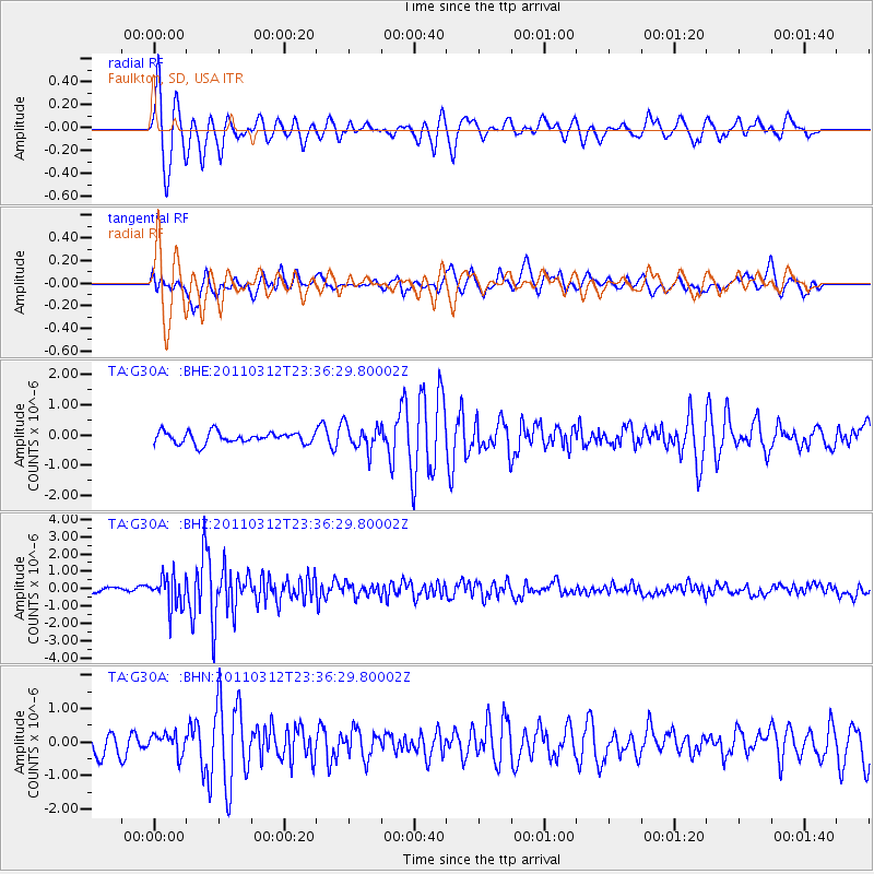
Earthquake location: Near East Coast Of Honshu, Japan
Earthquake latitude/longitude: 38.0/141.7
Earthquake time(UTC): 2011/03/12 (071) 23:24:48 GMT
Earthquake Depth: 15 km
Earthquake Magnitude: 6.0 MB, 5.6 MS, 6.1 MW, 5.9 MW
Earthquake Catalog/Contributor: WHDF/NEIC
Network: TA USArray Transportable Network (new EarthScope stations)
Station: G30A Faulkton, SD, USA
Lat/Lon: 45.13 N/99.14 W
Elevation: 496 m
Distance: 80.7 deg
Az: 38.795 deg
Baz: 315.671 deg
Ray Param: 0.048081595
Estimated Moho Depth: 10.25 km
Estimated Crust Vp/Vs: 1.60
Assumed Crust Vp: 6.53 km/s
Estimated Crust Vs: 4.082 km/s
Estimated Crust Poisson's Ratio: 0.18
Radial Match: 86.76408 %
Radial Bump: 400
Transverse Match: 64.21008 %
Transverse Bump: 400
SOD ConfigId: 356183
Insert Time: 2011-08-20 13:46:09.087 +0000
GWidth: 2.5
Max Bumps: 400
Tol: 0.001

Signal To Noise

ChannelStoNSTALTA
TA:G30A: :BHZ:20110312T23:36:29.80002Z5.73256259.0646245E-71.5812518E-7
TA:G30A: :BHN:20110312T23:36:29.80002Z1.02871993.271037E-73.179716E-7
TA:G30A: :BHE:20110312T23:36:29.80002Z2.15628084.0168138E-71.8628435E-7
Arrivals
Ps1.0 SECOND
PpPs4.0 SECOND
PsPs/PpSs4.9 SECOND