J31A Geddes, SD, USA - Earthquake Result Viewer
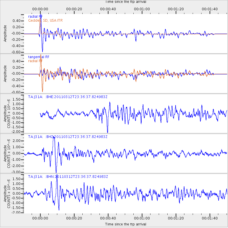
Earthquake location: Near East Coast Of Honshu, Japan
Earthquake latitude/longitude: 38.0/141.7
Earthquake time(UTC): 2011/03/12 (071) 23:24:48 GMT
Earthquake Depth: 15 km
Earthquake Magnitude: 6.0 MB, 5.6 MS, 6.1 MW, 5.9 MW
Earthquake Catalog/Contributor: WHDF/NEIC
Network: TA USArray Transportable Network (new EarthScope stations)
Station: J31A Geddes, SD, USA
Lat/Lon: 43.29 N/98.74 W
Elevation: 491 m
Distance: 82.2 deg
Az: 39.876 deg
Baz: 316.113 deg
Ray Param: 0.04701966
Estimated Moho Depth: 27.5 km
Estimated Crust Vp/Vs: 1.60
Assumed Crust Vp: 6.53 km/s
Estimated Crust Vs: 4.082 km/s
Estimated Crust Poisson's Ratio: 0.18
Radial Match: 81.72142 %
Radial Bump: 400
Transverse Match: 68.74368 %
Transverse Bump: 400
SOD ConfigId: 356183
Insert Time: 2011-08-20 14:07:38.935 +0000
GWidth: 2.5
Max Bumps: 400
Tol: 0.001

Signal To Noise

ChannelStoNSTALTA
TA:J31A: :BHZ:20110312T23:36:37.824983Z1.98805314.205524E-72.1153983E-7
TA:J31A: :BHN:20110312T23:36:37.824983Z2.17645722.7190188E-71.2492868E-7
TA:J31A: :BHE:20110312T23:36:37.824983Z1.51257573.2096654E-72.1219864E-7
Arrivals
Ps2.6 SECOND
PpPs11 SECOND
PsPs/PpSs13 SECOND