E31A Nome, ND, USA - Earthquake Result Viewer
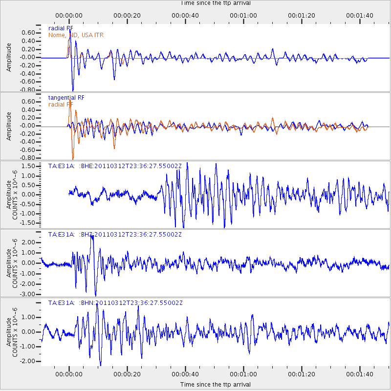
Earthquake location: Near East Coast Of Honshu, Japan
Earthquake latitude/longitude: 38.0/141.7
Earthquake time(UTC): 2011/03/12 (071) 23:24:48 GMT
Earthquake Depth: 15 km
Earthquake Magnitude: 6.0 MB, 5.6 MS, 6.1 MW, 5.9 MW
Earthquake Catalog/Contributor: WHDF/NEIC
Network: TA USArray Transportable Network (new EarthScope stations)
Station: E31A Nome, ND, USA
Lat/Lon: 46.56 N/97.89 W
Elevation: 427 m
Distance: 80.3 deg
Az: 37.147 deg
Baz: 316.298 deg
Ray Param: 0.048365362
Estimated Moho Depth: 14.25 km
Estimated Crust Vp/Vs: 2.08
Assumed Crust Vp: 6.498 km/s
Estimated Crust Vs: 3.124 km/s
Estimated Crust Poisson's Ratio: 0.35
Radial Match: 86.01183 %
Radial Bump: 400
Transverse Match: 78.914406 %
Transverse Bump: 400
SOD ConfigId: 356183
Insert Time: 2011-08-20 14:09:20.405 +0000
GWidth: 2.5
Max Bumps: 400
Tol: 0.001

Signal To Noise

ChannelStoNSTALTA
TA:E31A: :BHZ:20110312T23:36:27.55002Z2.76516916.992226E-72.5286792E-7
TA:E31A: :BHN:20110312T23:36:27.55002Z1.8730664.98279E-72.660232E-7
TA:E31A: :BHE:20110312T23:36:27.55002Z2.36994654.646925E-71.9607722E-7
Arrivals
Ps2.4 SECOND
PpPs6.6 SECOND
PsPs/PpSs9.0 SECOND