You are here: Home > Network List > US - United States National Seismic Network Stations List
> Station CBKS Cedar Bluff, Kansas, USA > Earthquake Result Viewer
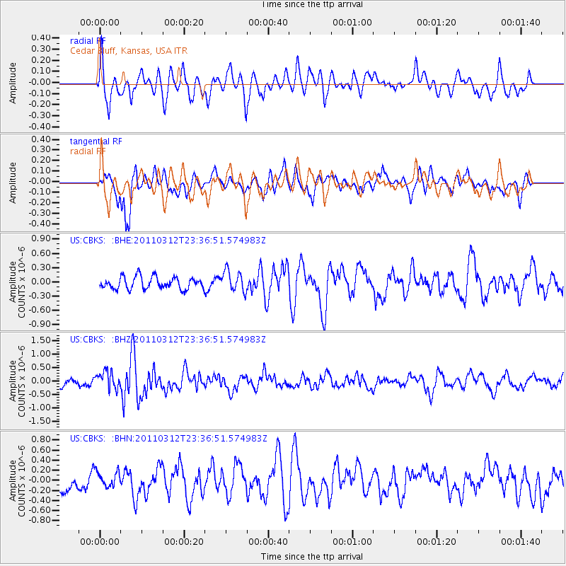
CBKS Cedar Bluff, Kansas, USA - Earthquake Result Viewer
*The percent match for this event was below the threshold and hence no stack was calculated.
| Earthquake location: |
Near East Coast Of Honshu, Japan |
| Earthquake latitude/longitude: |
38.0/141.7 |
| Earthquake time(UTC): |
2011/03/12 (071) 23:24:48 GMT |
| Earthquake Depth: |
15 km |
| Earthquake Magnitude: |
6.0 MB, 5.6 MS, 6.1 MW, 5.9 MW |
| Earthquake Catalog/Contributor: |
WHDF/NEIC |
|
| Network: |
US United States National Seismic Network |
| Station: |
CBKS Cedar Bluff, Kansas, USA |
| Lat/Lon: |
38.81 N/99.74 W |
| Elevation: |
677 m |
|
| Distance: |
84.9 deg |
| Az: |
43.55 deg |
| Baz: |
315.871 deg |
| Ray Param: |
$rayparam |
*The percent match for this event was below the threshold and hence was not used in the summary stack. |
|
| Radial Match: |
71.91461 % |
| Radial Bump: |
400 |
| Transverse Match: |
74.57593 % |
| Transverse Bump: |
400 |
| SOD ConfigId: |
356183 |
| Insert Time: |
2011-08-20 14:24:29.715 +0000 |
| GWidth: |
2.5 |
| Max Bumps: |
400 |
| Tol: |
0.001 |
|
Signal To Noise
| Channel | StoN | STA | LTA |
| US:CBKS: :BHZ:20110312T23:36:51.574983Z | 2.849497 | 3.341853E-7 | 1.172787E-7 |
| US:CBKS: :BHN:20110312T23:36:51.574983Z | 0.6992991 | 1.4615969E-7 | 2.0900885E-7 |
| US:CBKS: :BHE:20110312T23:36:51.574983Z | 1.79312 | 2.2531479E-7 | 1.2565516E-7 |
| Arrivals |
| Ps | |
| PpPs | |
| PsPs/PpSs | |


