You are here: Home > Network List > UW - Pacific Northwest Regional Seismic Network Stations List
> Station UMAT Pilot Rock, OR, USA > Earthquake Result Viewer
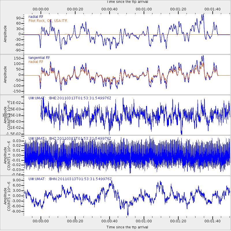
UMAT Pilot Rock, OR, USA - Earthquake Result Viewer
*The percent match for this event was below the threshold and hence no stack was calculated.
| Earthquake location: |
Off East Coast Of Honshu, Japan |
| Earthquake latitude/longitude: |
36.9/142.9 |
| Earthquake time(UTC): |
2011/03/13 (072) 01:42:51 GMT |
| Earthquake Depth: |
7.3 km |
| Earthquake Magnitude: |
5.5 MB, 5.2 MW |
| Earthquake Catalog/Contributor: |
WHDF/NEIC |
|
| Network: |
UW Pacific Northwest Regional Seismic Network |
| Station: |
UMAT Pilot Rock, OR, USA |
| Lat/Lon: |
45.29 N/118.96 W |
| Elevation: |
1318 m |
|
| Distance: |
69.9 deg |
| Az: |
48.077 deg |
| Baz: |
302.343 deg |
| Ray Param: |
$rayparam |
*The percent match for this event was below the threshold and hence was not used in the summary stack. |
|
| Radial Match: |
56.37159 % |
| Radial Bump: |
400 |
| Transverse Match: |
56.42417 % |
| Transverse Bump: |
400 |
| SOD ConfigId: |
356183 |
| Insert Time: |
2011-08-20 15:35:48.262 +0000 |
| GWidth: |
2.5 |
| Max Bumps: |
400 |
| Tol: |
0.001 |
|
Signal To Noise
| Channel | StoN | STA | LTA |
| UW:UMAT: :BHZ:20110313T01:53:31.549976Z | 0.9957493 | 1.5106657E-8 | 1.5171144E-8 |
| UW:UMAT: :BHN:20110313T01:53:31.549976Z | 1.8111185 | 4.343651E-6 | 2.3983253E-6 |
| UW:UMAT: :BHE:20110313T01:53:31.549976Z | 0.92122966 | 4.148537E-9 | 4.50326E-9 |
| Arrivals |
| Ps | |
| PpPs | |
| PsPs/PpSs | |


