You are here: Home > Network List > US - United States National Seismic Network Stations List
> Station ERPA Erie, Pennsylvania, USA > Earthquake Result Viewer
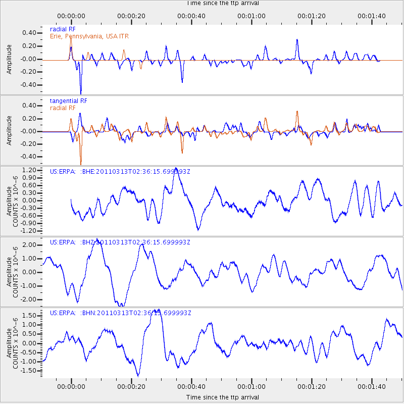
ERPA Erie, Pennsylvania, USA - Earthquake Result Viewer
*The percent match for this event was below the threshold and hence no stack was calculated.
| Earthquake location: |
Off East Coast Of Honshu, Japan |
| Earthquake latitude/longitude: |
36.3/142.3 |
| Earthquake time(UTC): |
2011/03/13 (072) 02:23:34 GMT |
| Earthquake Depth: |
10 km |
| Earthquake Magnitude: |
5.6 MB, 5.7 MS, 5.8 MW |
| Earthquake Catalog/Contributor: |
WHDF/NEIC |
|
| Network: |
US United States National Seismic Network |
| Station: |
ERPA Erie, Pennsylvania, USA |
| Lat/Lon: |
42.12 N/79.99 W |
| Elevation: |
306 m |
|
| Distance: |
92.9 deg |
| Az: |
30.11 deg |
| Baz: |
327.017 deg |
| Ray Param: |
$rayparam |
*The percent match for this event was below the threshold and hence was not used in the summary stack. |
|
| Radial Match: |
82.72962 % |
| Radial Bump: |
400 |
| Transverse Match: |
66.664314 % |
| Transverse Bump: |
400 |
| SOD ConfigId: |
356183 |
| Insert Time: |
2011-08-20 16:09:11.696 +0000 |
| GWidth: |
2.5 |
| Max Bumps: |
400 |
| Tol: |
0.001 |
|
Signal To Noise
| Channel | StoN | STA | LTA |
| US:ERPA: :BHZ:20110313T02:36:15.699993Z | 2.1940863 | 1.3554996E-6 | 6.177969E-7 |
| US:ERPA: :BHN:20110313T02:36:15.699993Z | 0.5528327 | 3.700291E-7 | 6.693329E-7 |
| US:ERPA: :BHE:20110313T02:36:15.699993Z | 2.015886 | 7.206211E-7 | 3.5747112E-7 |
| Arrivals |
| Ps | |
| PpPs | |
| PsPs/PpSs | |


