You are here: Home > Network List > CI - Caltech Regional Seismic Network Stations List
> Station FUR Furnace Creek, CA, USA > Earthquake Result Viewer
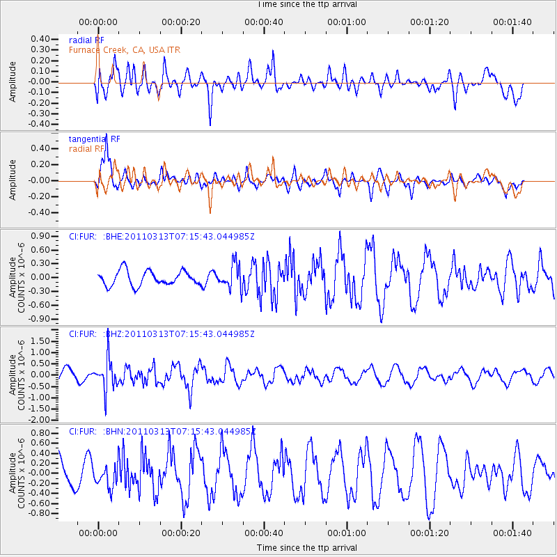
FUR Furnace Creek, CA, USA - Earthquake Result Viewer
*The percent match for this event was below the threshold and hence no stack was calculated.
| Earthquake location: |
Off East Coast Of Honshu, Japan |
| Earthquake latitude/longitude: |
38.3/144.0 |
| Earthquake time(UTC): |
2011/03/13 (072) 07:04:38 GMT |
| Earthquake Depth: |
35 km |
| Earthquake Magnitude: |
5.7 MB, 5.3 MW |
| Earthquake Catalog/Contributor: |
WHDF/NEIC |
|
| Network: |
CI Caltech Regional Seismic Network |
| Station: |
FUR Furnace Creek, CA, USA |
| Lat/Lon: |
36.47 N/116.86 W |
| Elevation: |
-37.0 m |
|
| Distance: |
74.6 deg |
| Az: |
55.632 deg |
| Baz: |
306.354 deg |
| Ray Param: |
$rayparam |
*The percent match for this event was below the threshold and hence was not used in the summary stack. |
|
| Radial Match: |
64.722595 % |
| Radial Bump: |
400 |
| Transverse Match: |
80.40137 % |
| Transverse Bump: |
400 |
| SOD ConfigId: |
356183 |
| Insert Time: |
2011-08-20 16:25:54.462 +0000 |
| GWidth: |
2.5 |
| Max Bumps: |
400 |
| Tol: |
0.001 |
|
Signal To Noise
| Channel | StoN | STA | LTA |
| CI:FUR: :BHZ:20110313T07:15:43.044985Z | 2.389354 | 6.8735017E-7 | 2.8767198E-7 |
| CI:FUR: :BHN:20110313T07:15:43.044985Z | 1.0326442 | 2.2222797E-7 | 2.1520286E-7 |
| CI:FUR: :BHE:20110313T07:15:43.044985Z | 1.7311511 | 2.7238718E-7 | 1.5734456E-7 |
| Arrivals |
| Ps | |
| PpPs | |
| PsPs/PpSs | |


