You are here: Home > Network List > TA - USArray Transportable Network (new EarthScope stations) Stations List
> Station O03E Paynes Creek, CA, USA > Earthquake Result Viewer
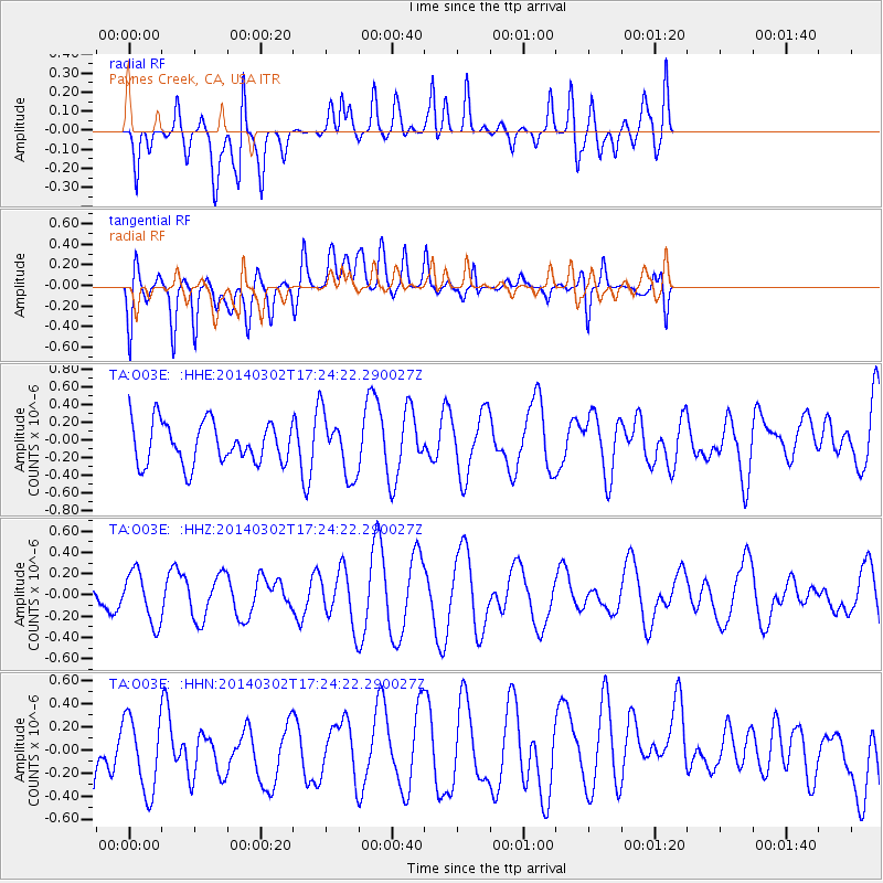
O03E Paynes Creek, CA, USA - Earthquake Result Viewer
*The percent match for this event was below the threshold and hence no stack was calculated.
| Earthquake location: |
Philippine Islands Region |
| Earthquake latitude/longitude: |
20.2/120.3 |
| Earthquake time(UTC): |
2014/03/02 (061) 17:11:26 GMT |
| Earthquake Depth: |
28 km |
| Earthquake Magnitude: |
4.8 MW |
| Earthquake Catalog/Contributor: |
ISC/ISC |
|
| Network: |
TA USArray Transportable Network (new EarthScope stations) |
| Station: |
O03E Paynes Creek, CA, USA |
| Lat/Lon: |
40.29 N/121.80 W |
| Elevation: |
967 m |
|
| Distance: |
96.6 deg |
| Az: |
42.89 deg |
| Baz: |
303.315 deg |
| Ray Param: |
$rayparam |
*The percent match for this event was below the threshold and hence was not used in the summary stack. |
|
| Radial Match: |
56.319088 % |
| Radial Bump: |
400 |
| Transverse Match: |
56.38702 % |
| Transverse Bump: |
400 |
| SOD ConfigId: |
3390531 |
| Insert Time: |
2019-04-10 11:55:10.126 +0000 |
| GWidth: |
2.5 |
| Max Bumps: |
400 |
| Tol: |
0.001 |
|
Signal To Noise
| Channel | StoN | STA | LTA |
| TA:O03E: :HHZ:20140302T17:24:22.290027Z | 0.74781275 | 2.405003E-7 | 3.2160497E-7 |
| TA:O03E: :HHN:20140302T17:24:22.290027Z | 1.0190899 | 3.358595E-7 | 3.2956808E-7 |
| TA:O03E: :HHE:20140302T17:24:22.290027Z | 1.4822141 | 3.484392E-7 | 2.3508018E-7 |
| Arrivals |
| Ps | |
| PpPs | |
| PsPs/PpSs | |


