You are here: Home > Network List > UW - Pacific Northwest Regional Seismic Network Stations List
> Station LEBA Lebam, WA, USA > Earthquake Result Viewer
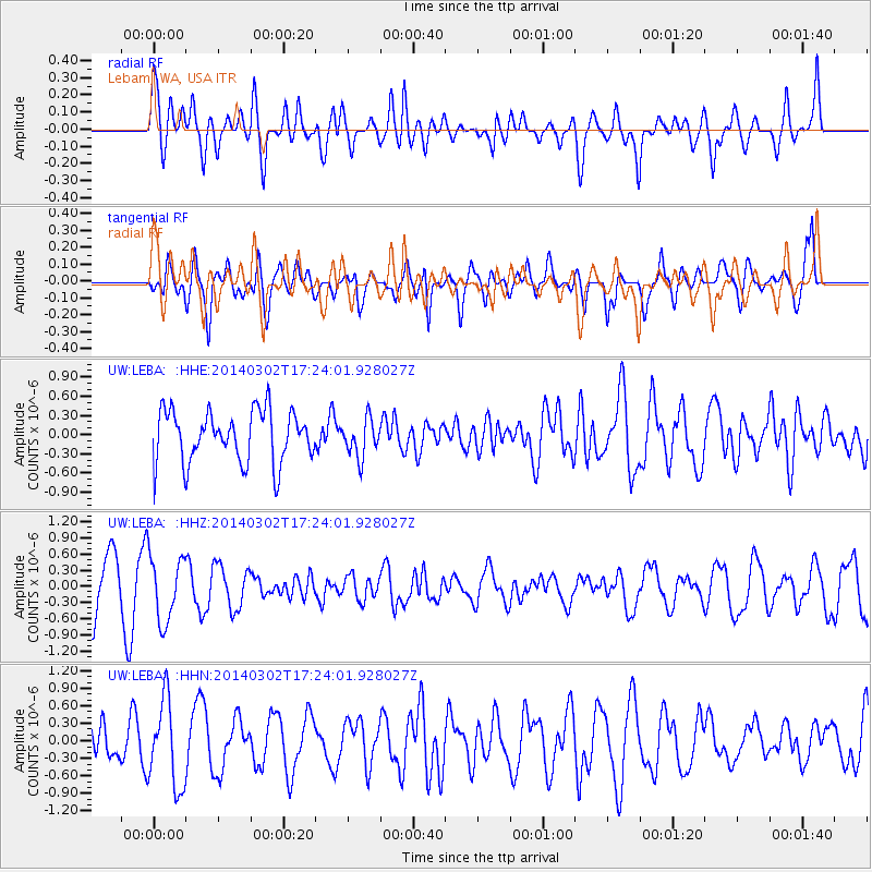
LEBA Lebam, WA, USA - Earthquake Result Viewer
*The percent match for this event was below the threshold and hence no stack was calculated.
| Earthquake location: |
Philippine Islands Region |
| Earthquake latitude/longitude: |
20.2/120.3 |
| Earthquake time(UTC): |
2014/03/02 (061) 17:11:26 GMT |
| Earthquake Depth: |
28 km |
| Earthquake Magnitude: |
4.8 MW |
| Earthquake Catalog/Contributor: |
ISC/ISC |
|
| Network: |
UW Pacific Northwest Regional Seismic Network |
| Station: |
LEBA Lebam, WA, USA |
| Lat/Lon: |
46.55 N/123.56 W |
| Elevation: |
73 m |
|
| Distance: |
92.1 deg |
| Az: |
38.328 deg |
| Baz: |
302.452 deg |
| Ray Param: |
$rayparam |
*The percent match for this event was below the threshold and hence was not used in the summary stack. |
|
| Radial Match: |
64.69957 % |
| Radial Bump: |
400 |
| Transverse Match: |
63.70865 % |
| Transverse Bump: |
400 |
| SOD ConfigId: |
3390531 |
| Insert Time: |
2019-04-10 11:55:18.765 +0000 |
| GWidth: |
2.5 |
| Max Bumps: |
400 |
| Tol: |
0.001 |
|
Signal To Noise
| Channel | StoN | STA | LTA |
| UW:LEBA: :HHZ:20140302T17:24:01.928027Z | 1.552879 | 6.0433854E-7 | 3.89173E-7 |
| UW:LEBA: :HHN:20140302T17:24:01.928027Z | 2.0501232 | 7.3587483E-7 | 3.5894178E-7 |
| UW:LEBA: :HHE:20140302T17:24:01.928027Z | 0.7285412 | 2.937229E-7 | 4.031658E-7 |
| Arrivals |
| Ps | |
| PpPs | |
| PsPs/PpSs | |


