You are here: Home > Network List > TA - USArray Transportable Network (new EarthScope stations) Stations List
> Station Q30A Quinter, KS, USA > Earthquake Result Viewer
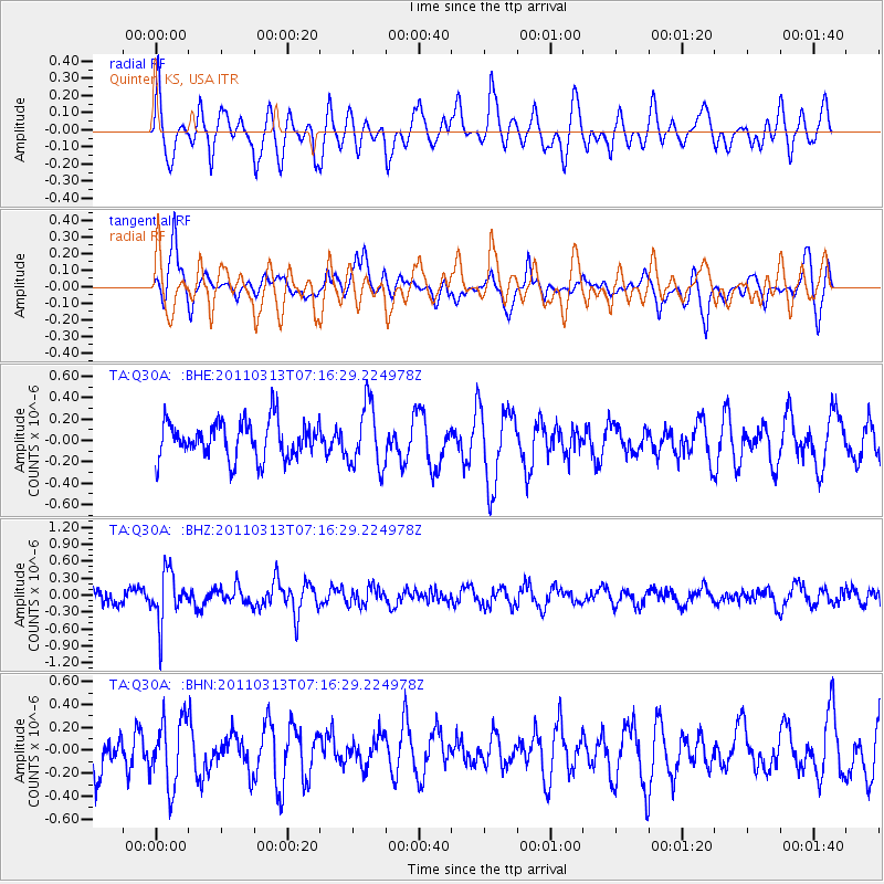
Q30A Quinter, KS, USA - Earthquake Result Viewer
*The percent match for this event was below the threshold and hence no stack was calculated.
| Earthquake location: |
Off East Coast Of Honshu, Japan |
| Earthquake latitude/longitude: |
38.3/144.0 |
| Earthquake time(UTC): |
2011/03/13 (072) 07:04:38 GMT |
| Earthquake Depth: |
35 km |
| Earthquake Magnitude: |
5.7 MB, 5.3 MW |
| Earthquake Catalog/Contributor: |
WHDF/NEIC |
|
| Network: |
TA USArray Transportable Network (new EarthScope stations) |
| Station: |
Q30A Quinter, KS, USA |
| Lat/Lon: |
38.98 N/100.22 W |
| Elevation: |
797 m |
|
| Distance: |
83.1 deg |
| Az: |
45.003 deg |
| Baz: |
314.476 deg |
| Ray Param: |
$rayparam |
*The percent match for this event was below the threshold and hence was not used in the summary stack. |
|
| Radial Match: |
39.928177 % |
| Radial Bump: |
400 |
| Transverse Match: |
66.4736 % |
| Transverse Bump: |
400 |
| SOD ConfigId: |
356183 |
| Insert Time: |
2011-08-20 17:01:33.927 +0000 |
| GWidth: |
2.5 |
| Max Bumps: |
400 |
| Tol: |
0.001 |
|
Signal To Noise
| Channel | StoN | STA | LTA |
| TA:Q30A: :BHZ:20110313T07:16:29.224978Z | 3.103075 | 4.3528746E-7 | 1.4027617E-7 |
| TA:Q30A: :BHN:20110313T07:16:29.224978Z | 1.3278592 | 2.88063E-7 | 2.1693792E-7 |
| TA:Q30A: :BHE:20110313T07:16:29.224978Z | 1.6823274 | 2.9319028E-7 | 1.742766E-7 |
| Arrivals |
| Ps | |
| PpPs | |
| PsPs/PpSs | |


