You are here: Home > Network List > TA - USArray Transportable Network (new EarthScope stations) Stations List
> Station A29A Manning Farm, Rocklake, ND, USA > Earthquake Result Viewer
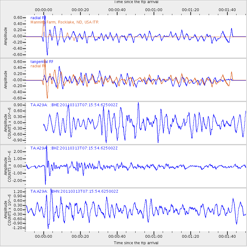
A29A Manning Farm, Rocklake, ND, USA - Earthquake Result Viewer
*The percent match for this event was below the threshold and hence no stack was calculated.
| Earthquake location: |
Off East Coast Of Honshu, Japan |
| Earthquake latitude/longitude: |
38.3/144.0 |
| Earthquake time(UTC): |
2011/03/13 (072) 07:04:38 GMT |
| Earthquake Depth: |
35 km |
| Earthquake Magnitude: |
5.7 MB, 5.3 MW |
| Earthquake Catalog/Contributor: |
WHDF/NEIC |
|
| Network: |
TA USArray Transportable Network (new EarthScope stations) |
| Station: |
A29A Manning Farm, Rocklake, ND, USA |
| Lat/Lon: |
48.92 N/99.23 W |
| Elevation: |
480 m |
|
| Distance: |
76.7 deg |
| Az: |
37.252 deg |
| Baz: |
313.795 deg |
| Ray Param: |
$rayparam |
*The percent match for this event was below the threshold and hence was not used in the summary stack. |
|
| Radial Match: |
69.52645 % |
| Radial Bump: |
400 |
| Transverse Match: |
72.375694 % |
| Transverse Bump: |
386 |
| SOD ConfigId: |
356183 |
| Insert Time: |
2011-08-20 17:20:26.960 +0000 |
| GWidth: |
2.5 |
| Max Bumps: |
400 |
| Tol: |
0.001 |
|
Signal To Noise
| Channel | StoN | STA | LTA |
| TA:A29A: :BHZ:20110313T07:15:54.625002Z | 6.24683 | 1.0265337E-6 | 1.6432874E-7 |
| TA:A29A: :BHN:20110313T07:15:54.625002Z | 2.1647637 | 7.404172E-7 | 3.4203143E-7 |
| TA:A29A: :BHE:20110313T07:15:54.625002Z | 1.3876864 | 4.591675E-7 | 3.3088708E-7 |
| Arrivals |
| Ps | |
| PpPs | |
| PsPs/PpSs | |


