You are here: Home > Network List > TA - USArray Transportable Network (new EarthScope stations) Stations List
> Station V34A Guthrie, OK, USA > Earthquake Result Viewer
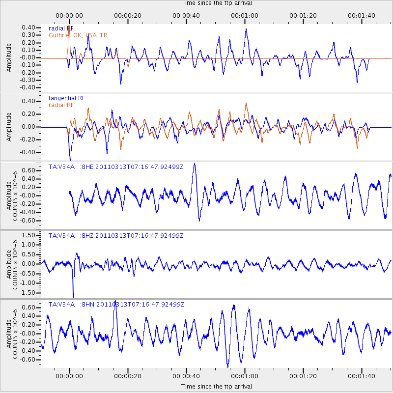
V34A Guthrie, OK, USA - Earthquake Result Viewer
*The percent match for this event was below the threshold and hence no stack was calculated.
| Earthquake location: |
Off East Coast Of Honshu, Japan |
| Earthquake latitude/longitude: |
38.3/144.0 |
| Earthquake time(UTC): |
2011/03/13 (072) 07:04:38 GMT |
| Earthquake Depth: |
35 km |
| Earthquake Magnitude: |
5.7 MB, 5.3 MW |
| Earthquake Catalog/Contributor: |
WHDF/NEIC |
|
| Network: |
TA USArray Transportable Network (new EarthScope stations) |
| Station: |
V34A Guthrie, OK, USA |
| Lat/Lon: |
35.83 N/97.52 W |
| Elevation: |
329 m |
|
| Distance: |
86.8 deg |
| Az: |
45.68 deg |
| Baz: |
316.171 deg |
| Ray Param: |
$rayparam |
*The percent match for this event was below the threshold and hence was not used in the summary stack. |
|
| Radial Match: |
40.70911 % |
| Radial Bump: |
364 |
| Transverse Match: |
60.06099 % |
| Transverse Bump: |
400 |
| SOD ConfigId: |
356183 |
| Insert Time: |
2011-08-20 17:30:44.001 +0000 |
| GWidth: |
2.5 |
| Max Bumps: |
400 |
| Tol: |
0.001 |
|
Signal To Noise
| Channel | StoN | STA | LTA |
| TA:V34A: :BHZ:20110313T07:16:47.92499Z | 3.4295976 | 4.816861E-7 | 1.4044974E-7 |
| TA:V34A: :BHN:20110313T07:16:47.92499Z | 0.8398322 | 1.7920252E-7 | 2.1337897E-7 |
| TA:V34A: :BHE:20110313T07:16:47.92499Z | 1.0809826 | 1.6446708E-7 | 1.5214592E-7 |
| Arrivals |
| Ps | |
| PpPs | |
| PsPs/PpSs | |


