You are here: Home > Network List > TA - USArray Transportable Network (new EarthScope stations) Stations List
> Station R36A Gordon, Harris, KS, USA > Earthquake Result Viewer
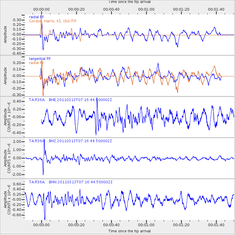
R36A Gordon, Harris, KS, USA - Earthquake Result Viewer
*The percent match for this event was below the threshold and hence no stack was calculated.
| Earthquake location: |
Off East Coast Of Honshu, Japan |
| Earthquake latitude/longitude: |
38.3/144.0 |
| Earthquake time(UTC): |
2011/03/13 (072) 07:04:38 GMT |
| Earthquake Depth: |
35 km |
| Earthquake Magnitude: |
5.7 MB, 5.3 MW |
| Earthquake Catalog/Contributor: |
WHDF/NEIC |
|
| Network: |
TA USArray Transportable Network (new EarthScope stations) |
| Station: |
R36A Gordon, Harris, KS, USA |
| Lat/Lon: |
38.32 N/95.50 W |
| Elevation: |
354 m |
|
| Distance: |
86.1 deg |
| Az: |
42.798 deg |
| Baz: |
317.203 deg |
| Ray Param: |
$rayparam |
*The percent match for this event was below the threshold and hence was not used in the summary stack. |
|
| Radial Match: |
56.62853 % |
| Radial Bump: |
400 |
| Transverse Match: |
47.207546 % |
| Transverse Bump: |
400 |
| SOD ConfigId: |
356183 |
| Insert Time: |
2011-08-20 17:41:15.573 +0000 |
| GWidth: |
2.5 |
| Max Bumps: |
400 |
| Tol: |
0.001 |
|
Signal To Noise
| Channel | StoN | STA | LTA |
| TA:R36A: :BHZ:20110313T07:16:44.500002Z | 6.200284 | 8.064376E-7 | 1.3006462E-7 |
| TA:R36A: :BHN:20110313T07:16:44.500002Z | 1.5498472 | 2.8202882E-7 | 1.8197203E-7 |
| TA:R36A: :BHE:20110313T07:16:44.500002Z | 1.4327095 | 2.0965257E-7 | 1.4633294E-7 |
| Arrivals |
| Ps | |
| PpPs | |
| PsPs/PpSs | |


