You are here: Home > Network List > TA - USArray Transportable Network (new EarthScope stations) Stations List
> Station U35A Pawnee, OK, USA > Earthquake Result Viewer
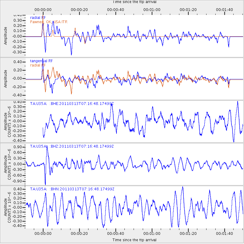
U35A Pawnee, OK, USA - Earthquake Result Viewer
*The percent match for this event was below the threshold and hence no stack was calculated.
| Earthquake location: |
Off East Coast Of Honshu, Japan |
| Earthquake latitude/longitude: |
38.3/144.0 |
| Earthquake time(UTC): |
2011/03/13 (072) 07:04:38 GMT |
| Earthquake Depth: |
35 km |
| Earthquake Magnitude: |
5.7 MB, 5.3 MW |
| Earthquake Catalog/Contributor: |
WHDF/NEIC |
|
| Network: |
TA USArray Transportable Network (new EarthScope stations) |
| Station: |
U35A Pawnee, OK, USA |
| Lat/Lon: |
36.37 N/96.73 W |
| Elevation: |
303 m |
|
| Distance: |
86.9 deg |
| Az: |
44.849 deg |
| Baz: |
316.587 deg |
| Ray Param: |
$rayparam |
*The percent match for this event was below the threshold and hence was not used in the summary stack. |
|
| Radial Match: |
47.811382 % |
| Radial Bump: |
400 |
| Transverse Match: |
58.512047 % |
| Transverse Bump: |
400 |
| SOD ConfigId: |
356183 |
| Insert Time: |
2011-08-20 17:55:00.841 +0000 |
| GWidth: |
2.5 |
| Max Bumps: |
400 |
| Tol: |
0.001 |
|
Signal To Noise
| Channel | StoN | STA | LTA |
| TA:U35A: :BHZ:20110313T07:16:48.17499Z | 4.9319096 | 4.6175992E-7 | 9.362701E-8 |
| TA:U35A: :BHN:20110313T07:16:48.17499Z | 1.5528669 | 1.8513867E-7 | 1.1922378E-7 |
| TA:U35A: :BHE:20110313T07:16:48.17499Z | 0.86283636 | 8.745911E-8 | 1.01362325E-7 |
| Arrivals |
| Ps | |
| PpPs | |
| PsPs/PpSs | |


