You are here: Home > Network List > TA - USArray Transportable Network (new EarthScope stations) Stations List
> Station E31A Nome, ND, USA > Earthquake Result Viewer
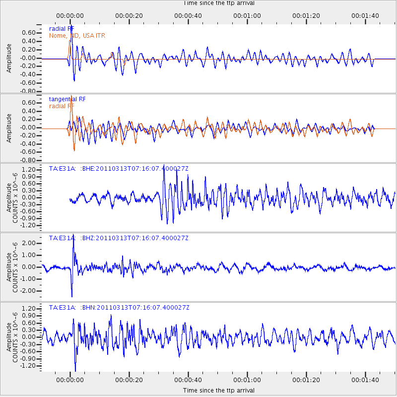
E31A Nome, ND, USA - Earthquake Result Viewer
*The percent match for this event was below the threshold and hence no stack was calculated.
| Earthquake location: |
Off East Coast Of Honshu, Japan |
| Earthquake latitude/longitude: |
38.3/144.0 |
| Earthquake time(UTC): |
2011/03/13 (072) 07:04:38 GMT |
| Earthquake Depth: |
35 km |
| Earthquake Magnitude: |
5.7 MB, 5.3 MW |
| Earthquake Catalog/Contributor: |
WHDF/NEIC |
|
| Network: |
TA USArray Transportable Network (new EarthScope stations) |
| Station: |
E31A Nome, ND, USA |
| Lat/Lon: |
46.56 N/97.89 W |
| Elevation: |
427 m |
|
| Distance: |
79.0 deg |
| Az: |
38.332 deg |
| Baz: |
315.015 deg |
| Ray Param: |
$rayparam |
*The percent match for this event was below the threshold and hence was not used in the summary stack. |
|
| Radial Match: |
77.41336 % |
| Radial Bump: |
400 |
| Transverse Match: |
67.76 % |
| Transverse Bump: |
400 |
| SOD ConfigId: |
356183 |
| Insert Time: |
2011-08-20 18:03:10.193 +0000 |
| GWidth: |
2.5 |
| Max Bumps: |
400 |
| Tol: |
0.001 |
|
Signal To Noise
| Channel | StoN | STA | LTA |
| TA:E31A: :BHZ:20110313T07:16:07.400027Z | 5.1755314 | 8.792077E-7 | 1.6987775E-7 |
| TA:E31A: :BHN:20110313T07:16:07.400027Z | 2.7429893 | 4.852323E-7 | 1.7689908E-7 |
| TA:E31A: :BHE:20110313T07:16:07.400027Z | 3.934393 | 5.8210605E-7 | 1.479532E-7 |
| Arrivals |
| Ps | |
| PpPs | |
| PsPs/PpSs | |


