You are here: Home > Network List > US - United States National Seismic Network Stations List
> Station DGMT Dagmar, Montana, USA > Earthquake Result Viewer
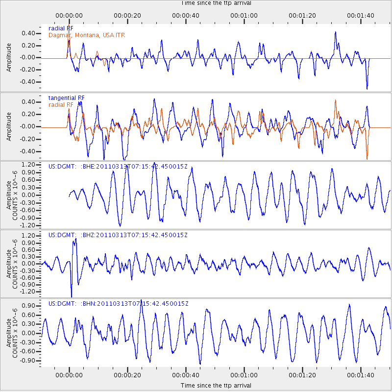
DGMT Dagmar, Montana, USA - Earthquake Result Viewer
*The percent match for this event was below the threshold and hence no stack was calculated.
| Earthquake location: |
Off East Coast Of Honshu, Japan |
| Earthquake latitude/longitude: |
38.3/144.0 |
| Earthquake time(UTC): |
2011/03/13 (072) 07:04:38 GMT |
| Earthquake Depth: |
35 km |
| Earthquake Magnitude: |
5.7 MB, 5.3 MW |
| Earthquake Catalog/Contributor: |
WHDF/NEIC |
|
| Network: |
US United States National Seismic Network |
| Station: |
DGMT Dagmar, Montana, USA |
| Lat/Lon: |
48.47 N/104.20 W |
| Elevation: |
0.0 m |
|
| Distance: |
74.5 deg |
| Az: |
39.881 deg |
| Baz: |
310.731 deg |
| Ray Param: |
$rayparam |
*The percent match for this event was below the threshold and hence was not used in the summary stack. |
|
| Radial Match: |
38.49274 % |
| Radial Bump: |
344 |
| Transverse Match: |
47.873924 % |
| Transverse Bump: |
400 |
| SOD ConfigId: |
356183 |
| Insert Time: |
2011-08-20 18:39:47.221 +0000 |
| GWidth: |
2.5 |
| Max Bumps: |
400 |
| Tol: |
0.001 |
|
Signal To Noise
| Channel | StoN | STA | LTA |
| US:DGMT: :BHZ:20110313T07:15:42.450015Z | 4.609238 | 6.632582E-7 | 1.4389758E-7 |
| US:DGMT: :BHN:20110313T07:15:42.450015Z | 0.9254164 | 2.8340176E-7 | 3.0624244E-7 |
| US:DGMT: :BHE:20110313T07:15:42.450015Z | 1.5609267 | 7.631041E-7 | 4.8887887E-7 |
| Arrivals |
| Ps | |
| PpPs | |
| PsPs/PpSs | |


