You are here: Home > Network List > TA - USArray Transportable Network (new EarthScope stations) Stations List
> Station B30A Myrvik Farm, Edmore, ND, USA > Earthquake Result Viewer
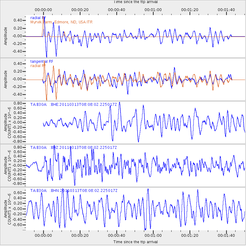
B30A Myrvik Farm, Edmore, ND, USA - Earthquake Result Viewer
*The percent match for this event was below the threshold and hence no stack was calculated.
| Earthquake location: |
Off East Coast Of Honshu, Japan |
| Earthquake latitude/longitude: |
39.6/143.2 |
| Earthquake time(UTC): |
2011/03/13 (072) 07:56:42 GMT |
| Earthquake Depth: |
13 km |
| Earthquake Magnitude: |
5.6 MB, 5.4 MS, 5.8 MW, 5.7 MW |
| Earthquake Catalog/Contributor: |
WHDF/NEIC |
|
| Network: |
TA USArray Transportable Network (new EarthScope stations) |
| Station: |
B30A Myrvik Farm, Edmore, ND, USA |
| Lat/Lon: |
48.45 N/98.33 W |
| Elevation: |
480 m |
|
| Distance: |
76.8 deg |
| Az: |
36.949 deg |
| Baz: |
315.801 deg |
| Ray Param: |
$rayparam |
*The percent match for this event was below the threshold and hence was not used in the summary stack. |
|
| Radial Match: |
73.70756 % |
| Radial Bump: |
368 |
| Transverse Match: |
54.00293 % |
| Transverse Bump: |
382 |
| SOD ConfigId: |
356183 |
| Insert Time: |
2011-08-20 19:22:52.830 +0000 |
| GWidth: |
2.5 |
| Max Bumps: |
400 |
| Tol: |
0.001 |
|
Signal To Noise
| Channel | StoN | STA | LTA |
| TA:B30A: :BHZ:20110313T08:08:02.225017Z | 3.0684357 | 3.1995103E-7 | 1.0427171E-7 |
| TA:B30A: :BHN:20110313T08:08:02.225017Z | 1.2237242 | 2.9565575E-7 | 2.4160326E-7 |
| TA:B30A: :BHE:20110313T08:08:02.225017Z | 1.4339417 | 2.2383229E-7 | 1.5609581E-7 |
| Arrivals |
| Ps | |
| PpPs | |
| PsPs/PpSs | |


