You are here: Home > Network List > TA - USArray Transportable Network (new EarthScope stations) Stations List
> Station V39A Pettigrew, AR, USA > Earthquake Result Viewer
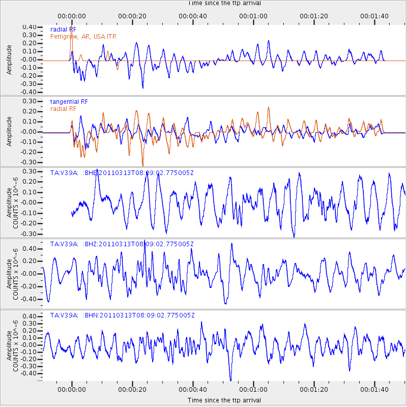
V39A Pettigrew, AR, USA - Earthquake Result Viewer
*The percent match for this event was below the threshold and hence no stack was calculated.
| Earthquake location: |
Off East Coast Of Honshu, Japan |
| Earthquake latitude/longitude: |
39.6/143.2 |
| Earthquake time(UTC): |
2011/03/13 (072) 07:56:42 GMT |
| Earthquake Depth: |
13 km |
| Earthquake Magnitude: |
5.6 MB, 5.4 MS, 5.8 MW, 5.7 MW |
| Earthquake Catalog/Contributor: |
WHDF/NEIC |
|
| Network: |
TA USArray Transportable Network (new EarthScope stations) |
| Station: |
V39A Pettigrew, AR, USA |
| Lat/Lon: |
35.84 N/93.64 W |
| Elevation: |
744 m |
|
| Distance: |
88.4 deg |
| Az: |
42.871 deg |
| Baz: |
319.719 deg |
| Ray Param: |
$rayparam |
*The percent match for this event was below the threshold and hence was not used in the summary stack. |
|
| Radial Match: |
60.940506 % |
| Radial Bump: |
400 |
| Transverse Match: |
52.180714 % |
| Transverse Bump: |
400 |
| SOD ConfigId: |
356183 |
| Insert Time: |
2011-08-20 19:39:58.858 +0000 |
| GWidth: |
2.5 |
| Max Bumps: |
400 |
| Tol: |
0.001 |
|
Signal To Noise
| Channel | StoN | STA | LTA |
| TA:V39A: :BHZ:20110313T08:09:02.775005Z | 1.3422992 | 1.8107073E-7 | 1.3489594E-7 |
| TA:V39A: :BHN:20110313T08:09:02.775005Z | 1.1991659 | 1.3087119E-7 | 1.0913518E-7 |
| TA:V39A: :BHE:20110313T08:09:02.775005Z | 1.2334257 | 1.3751215E-7 | 1.1148798E-7 |
| Arrivals |
| Ps | |
| PpPs | |
| PsPs/PpSs | |


