You are here: Home > Network List > TA - USArray Transportable Network (new EarthScope stations) Stations List
> Station K30A Basset, NE, USA > Earthquake Result Viewer
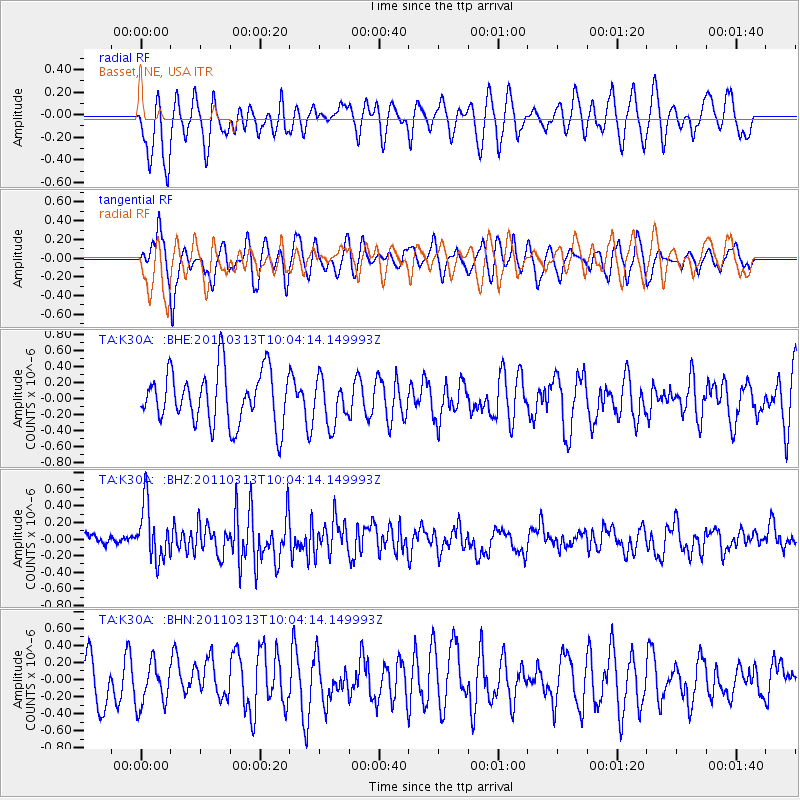
K30A Basset, NE, USA - Earthquake Result Viewer
*The percent match for this event was below the threshold and hence no stack was calculated.
| Earthquake location: |
Near East Coast Of Honshu, Japan |
| Earthquake latitude/longitude: |
38.8/141.9 |
| Earthquake time(UTC): |
2011/03/13 (072) 09:52:30 GMT |
| Earthquake Depth: |
33 km |
| Earthquake Magnitude: |
5.6 MW, 5.0 MS, 5.4 MB, 5.6 MW |
| Earthquake Catalog/Contributor: |
WHDF/NEIC |
|
| Network: |
TA USArray Transportable Network (new EarthScope stations) |
| Station: |
K30A Basset, NE, USA |
| Lat/Lon: |
42.67 N/99.61 W |
| Elevation: |
712 m |
|
| Distance: |
81.6 deg |
| Az: |
40.923 deg |
| Baz: |
316.087 deg |
| Ray Param: |
$rayparam |
*The percent match for this event was below the threshold and hence was not used in the summary stack. |
|
| Radial Match: |
57.971542 % |
| Radial Bump: |
400 |
| Transverse Match: |
69.40592 % |
| Transverse Bump: |
400 |
| SOD ConfigId: |
356183 |
| Insert Time: |
2011-08-20 20:24:33.711 +0000 |
| GWidth: |
2.5 |
| Max Bumps: |
400 |
| Tol: |
0.001 |
|
Signal To Noise
| Channel | StoN | STA | LTA |
| TA:K30A: :BHZ:20110313T10:04:14.149993Z | 1.9450787 | 3.3362667E-7 | 1.7152348E-7 |
| TA:K30A: :BHN:20110313T10:04:14.149993Z | 0.7763882 | 2.5018906E-7 | 3.222474E-7 |
| TA:K30A: :BHE:20110313T10:04:14.149993Z | 0.83804566 | 2.7675935E-7 | 3.3024375E-7 |
| Arrivals |
| Ps | |
| PpPs | |
| PsPs/PpSs | |


