You are here: Home > Network List > TA - USArray Transportable Network (new EarthScope stations) Stations List
> Station W36A Wetumka, OK, USA > Earthquake Result Viewer
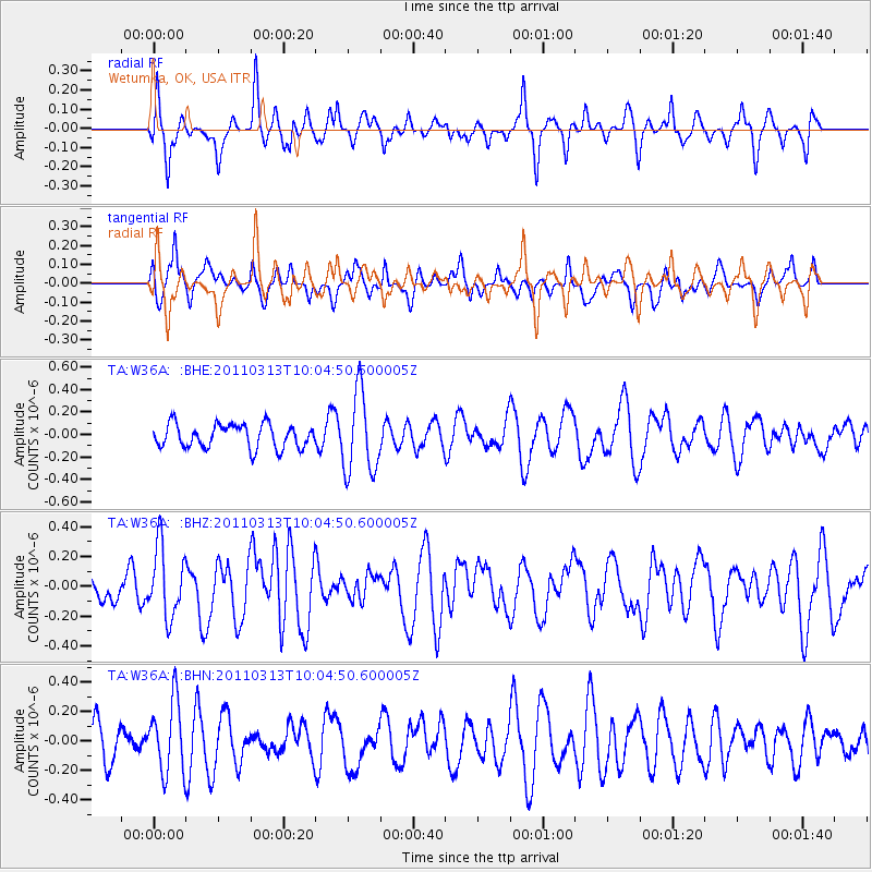
W36A Wetumka, OK, USA - Earthquake Result Viewer
*The percent match for this event was below the threshold and hence no stack was calculated.
| Earthquake location: |
Near East Coast Of Honshu, Japan |
| Earthquake latitude/longitude: |
38.8/141.9 |
| Earthquake time(UTC): |
2011/03/13 (072) 09:52:30 GMT |
| Earthquake Depth: |
33 km |
| Earthquake Magnitude: |
5.6 MW, 5.0 MS, 5.4 MB, 5.6 MW |
| Earthquake Catalog/Contributor: |
WHDF/NEIC |
|
| Network: |
TA USArray Transportable Network (new EarthScope stations) |
| Station: |
W36A Wetumka, OK, USA |
| Lat/Lon: |
35.14 N/96.23 W |
| Elevation: |
251 m |
|
| Distance: |
88.9 deg |
| Az: |
44.092 deg |
| Baz: |
318.476 deg |
| Ray Param: |
$rayparam |
*The percent match for this event was below the threshold and hence was not used in the summary stack. |
|
| Radial Match: |
46.361492 % |
| Radial Bump: |
267 |
| Transverse Match: |
50.185883 % |
| Transverse Bump: |
359 |
| SOD ConfigId: |
356183 |
| Insert Time: |
2011-08-20 20:27:29.267 +0000 |
| GWidth: |
2.5 |
| Max Bumps: |
400 |
| Tol: |
0.001 |
|
Signal To Noise
| Channel | StoN | STA | LTA |
| TA:W36A: :BHZ:20110313T10:04:50.600005Z | 1.6506625 | 2.3489477E-7 | 1.4230332E-7 |
| TA:W36A: :BHN:20110313T10:04:50.600005Z | 1.4672025 | 2.4250528E-7 | 1.6528412E-7 |
| TA:W36A: :BHE:20110313T10:04:50.600005Z | 3.447391 | 3.622218E-7 | 1.0507129E-7 |
| Arrivals |
| Ps | |
| PpPs | |
| PsPs/PpSs | |


