You are here: Home > Network List > TA - USArray Transportable Network (new EarthScope stations) Stations List
> Station L32A Elgin, NE, USA > Earthquake Result Viewer
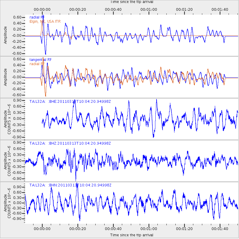
L32A Elgin, NE, USA - Earthquake Result Viewer
*The percent match for this event was below the threshold and hence no stack was calculated.
| Earthquake location: |
Near East Coast Of Honshu, Japan |
| Earthquake latitude/longitude: |
38.8/141.9 |
| Earthquake time(UTC): |
2011/03/13 (072) 09:52:30 GMT |
| Earthquake Depth: |
33 km |
| Earthquake Magnitude: |
5.6 MW, 5.0 MS, 5.4 MB, 5.6 MW |
| Earthquake Catalog/Contributor: |
WHDF/NEIC |
|
| Network: |
TA USArray Transportable Network (new EarthScope stations) |
| Station: |
L32A Elgin, NE, USA |
| Lat/Lon: |
42.00 N/98.01 W |
| Elevation: |
586 m |
|
| Distance: |
82.9 deg |
| Az: |
40.514 deg |
| Baz: |
317.109 deg |
| Ray Param: |
$rayparam |
*The percent match for this event was below the threshold and hence was not used in the summary stack. |
|
| Radial Match: |
49.052994 % |
| Radial Bump: |
400 |
| Transverse Match: |
61.19711 % |
| Transverse Bump: |
400 |
| SOD ConfigId: |
356183 |
| Insert Time: |
2011-08-20 20:31:03.645 +0000 |
| GWidth: |
2.5 |
| Max Bumps: |
400 |
| Tol: |
0.001 |
|
Signal To Noise
| Channel | StoN | STA | LTA |
| TA:L32A: :BHZ:20110313T10:04:20.94998Z | 2.1571903 | 3.3794458E-7 | 1.5665961E-7 |
| TA:L32A: :BHN:20110313T10:04:20.94998Z | 1.144616 | 3.5743778E-7 | 3.1227745E-7 |
| TA:L32A: :BHE:20110313T10:04:20.94998Z | 1.0517555 | 2.9447614E-7 | 2.7998533E-7 |
| Arrivals |
| Ps | |
| PpPs | |
| PsPs/PpSs | |


