You are here: Home > Network List > TA - USArray Transportable Network (new EarthScope stations) Stations List
> Station T25A Trinidad, CO, USA > Earthquake Result Viewer
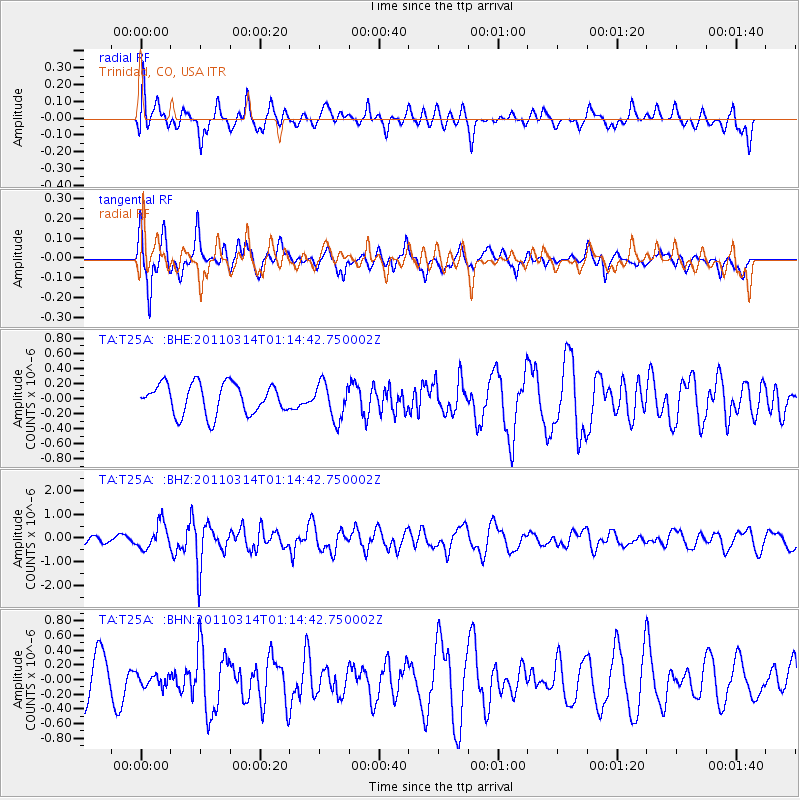
T25A Trinidad, CO, USA - Earthquake Result Viewer
*The percent match for this event was below the threshold and hence no stack was calculated.
| Earthquake location: |
Near East Coast Of Honshu, Japan |
| Earthquake latitude/longitude: |
36.4/140.9 |
| Earthquake time(UTC): |
2011/03/14 (073) 01:02:38 GMT |
| Earthquake Depth: |
11 km |
| Earthquake Magnitude: |
6.0 MB, 5.6 MS, 5.7 MW, 5.5 MW |
| Earthquake Catalog/Contributor: |
WHDF/NEIC |
|
| Network: |
TA USArray Transportable Network (new EarthScope stations) |
| Station: |
T25A Trinidad, CO, USA |
| Lat/Lon: |
37.14 N/104.41 W |
| Elevation: |
2017 m |
|
| Distance: |
85.1 deg |
| Az: |
46.78 deg |
| Baz: |
312.638 deg |
| Ray Param: |
$rayparam |
*The percent match for this event was below the threshold and hence was not used in the summary stack. |
|
| Radial Match: |
50.708706 % |
| Radial Bump: |
400 |
| Transverse Match: |
67.47555 % |
| Transverse Bump: |
379 |
| SOD ConfigId: |
356183 |
| Insert Time: |
2011-08-20 22:31:46.457 +0000 |
| GWidth: |
2.5 |
| Max Bumps: |
400 |
| Tol: |
0.001 |
|
Signal To Noise
| Channel | StoN | STA | LTA |
| TA:T25A: :BHZ:20110314T01:14:42.750002Z | 2.5670443 | 5.3416704E-7 | 2.0808642E-7 |
| TA:T25A: :BHN:20110314T01:14:42.750002Z | 0.27504158 | 8.174898E-8 | 2.972241E-7 |
| TA:T25A: :BHE:20110314T01:14:42.750002Z | 1.1987354 | 2.4058886E-7 | 2.0070223E-7 |
| Arrivals |
| Ps | |
| PpPs | |
| PsPs/PpSs | |


