You are here: Home > Network List > TA - USArray Transportable Network (new EarthScope stations) Stations List
> Station K33A Hardington, NE, USA > Earthquake Result Viewer
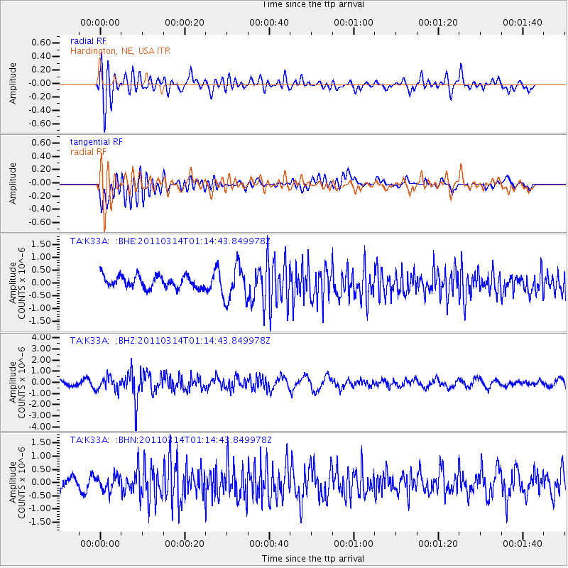
K33A Hardington, NE, USA - Earthquake Result Viewer
*The percent match for this event was below the threshold and hence no stack was calculated.
| Earthquake location: |
Near East Coast Of Honshu, Japan |
| Earthquake latitude/longitude: |
36.4/140.9 |
| Earthquake time(UTC): |
2011/03/14 (073) 01:02:38 GMT |
| Earthquake Depth: |
11 km |
| Earthquake Magnitude: |
6.0 MB, 5.6 MS, 5.7 MW, 5.5 MW |
| Earthquake Catalog/Contributor: |
WHDF/NEIC |
|
| Network: |
TA USArray Transportable Network (new EarthScope stations) |
| Station: |
K33A Hardington, NE, USA |
| Lat/Lon: |
42.61 N/97.00 W |
| Elevation: |
507 m |
|
| Distance: |
85.3 deg |
| Az: |
38.867 deg |
| Baz: |
316.713 deg |
| Ray Param: |
$rayparam |
*The percent match for this event was below the threshold and hence was not used in the summary stack. |
|
| Radial Match: |
63.951843 % |
| Radial Bump: |
400 |
| Transverse Match: |
74.080345 % |
| Transverse Bump: |
400 |
| SOD ConfigId: |
356183 |
| Insert Time: |
2011-08-20 22:39:36.910 +0000 |
| GWidth: |
2.5 |
| Max Bumps: |
400 |
| Tol: |
0.001 |
|
Signal To Noise
| Channel | StoN | STA | LTA |
| TA:K33A: :BHZ:20110314T01:14:43.849978Z | 2.4281387 | 5.606432E-7 | 2.3089419E-7 |
| TA:K33A: :BHN:20110314T01:14:43.849978Z | 0.76835907 | 2.7253316E-7 | 3.5469503E-7 |
| TA:K33A: :BHE:20110314T01:14:43.849978Z | 2.9451184 | 6.810626E-7 | 2.3125135E-7 |
| Arrivals |
| Ps | |
| PpPs | |
| PsPs/PpSs | |


