You are here: Home > Network List > TA - USArray Transportable Network (new EarthScope stations) Stations List
> Station 341A Kurthwood, LA, USA > Earthquake Result Viewer
341A Kurthwood, LA, USA - Earthquake Result Viewer
*The percent match for this event was below the threshold and hence no stack was calculated.
| Earthquake location: |
Near East Coast Of Honshu, Japan |
| Earthquake latitude/longitude: |
36.4/140.9 |
| Earthquake time(UTC): |
2011/03/14 (073) 01:02:38 GMT |
| Earthquake Depth: |
11 km |
| Earthquake Magnitude: |
6.0 MB, 5.6 MS, 5.7 MW, 5.5 MW |
| Earthquake Catalog/Contributor: |
WHDF/NEIC |
|
| Network: |
TA USArray Transportable Network (new EarthScope stations) |
| Station: |
341A Kurthwood, LA, USA |
| Lat/Lon: |
31.33 N/93.17 W |
| Elevation: |
93 m |
|
| Distance: |
95.7 deg |
| Az: |
44.128 deg |
| Baz: |
318.974 deg |
| Ray Param: |
$rayparam |
*The percent match for this event was below the threshold and hence was not used in the summary stack. |
|
| Radial Match: |
68.370255 % |
| Radial Bump: |
327 |
| Transverse Match: |
65.04361 % |
| Transverse Bump: |
346 |
| SOD ConfigId: |
356183 |
| Insert Time: |
2011-08-20 22:44:34.354 +0000 |
| GWidth: |
2.5 |
| Max Bumps: |
400 |
| Tol: |
0.001 |
|
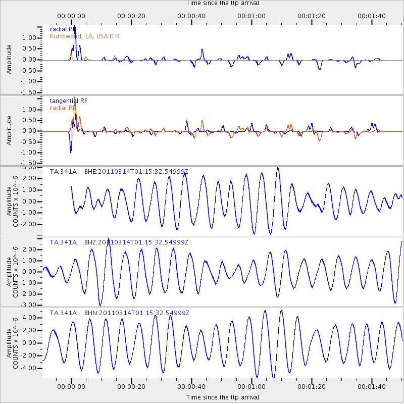
Signal To Noise
| Channel | StoN | STA | LTA |
| TA:341A: :BHZ:20110314T01:15:32.54999Z | 1.3449836 | 9.969863E-7 | 7.412628E-7 |
| TA:341A: :BHN:20110314T01:15:32.54999Z | 1.7997416 | 2.656018E-6 | 1.4757775E-6 |
| TA:341A: :BHE:20110314T01:15:32.54999Z | 1.6423064 | 1.5024843E-6 | 9.1486237E-7 |
| Arrivals |
| Ps | |
| PpPs | |
| PsPs/PpSs | |


