You are here: Home > Network List > IC - New China Digital Seismograph Network Stations List
> Station KMI Kunming, Yunnan Province, China > Earthquake Result Viewer
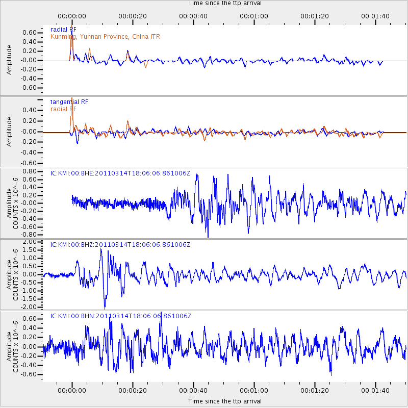
KMI Kunming, Yunnan Province, China - Earthquake Result Viewer
*The percent match for this event was below the threshold and hence no stack was calculated.
| Earthquake location: |
Off East Coast Of Honshu, Japan |
| Earthquake latitude/longitude: |
37.2/142.2 |
| Earthquake time(UTC): |
2011/03/14 (073) 17:59:41 GMT |
| Earthquake Depth: |
20 km |
| Earthquake Magnitude: |
5.7 MW, 5.4 MS, 5.4 MB, 5.6 MW |
| Earthquake Catalog/Contributor: |
WHDF/NEIC |
|
| Network: |
IC New China Digital Seismograph Network |
| Station: |
KMI Kunming, Yunnan Province, China |
| Lat/Lon: |
25.12 N/102.74 E |
| Elevation: |
1975 m |
|
| Distance: |
35.6 deg |
| Az: |
261.712 deg |
| Baz: |
60.643 deg |
| Ray Param: |
$rayparam |
*The percent match for this event was below the threshold and hence was not used in the summary stack. |
|
| Radial Match: |
73.97521 % |
| Radial Bump: |
400 |
| Transverse Match: |
63.098896 % |
| Transverse Bump: |
400 |
| SOD ConfigId: |
356183 |
| Insert Time: |
2011-08-20 23:51:57.306 +0000 |
| GWidth: |
2.5 |
| Max Bumps: |
400 |
| Tol: |
0.001 |
|
Signal To Noise
| Channel | StoN | STA | LTA |
| IC:KMI:00:BHZ:20110314T18:06:06.861006Z | 6.409233 | 4.3338923E-7 | 6.761952E-8 |
| IC:KMI:00:BHN:20110314T18:06:06.861006Z | 1.8558905 | 1.5740218E-7 | 8.4812214E-8 |
| IC:KMI:00:BHE:20110314T18:06:06.861006Z | 2.8248105 | 2.0350036E-7 | 7.204036E-8 |
| Arrivals |
| Ps | |
| PpPs | |
| PsPs/PpSs | |


