You are here: Home > Network List > TA - USArray Transportable Network (new EarthScope stations) Stations List
> Station G65A Princeton, ME, USA > Earthquake Result Viewer
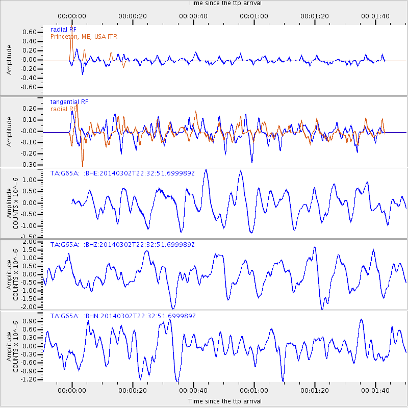
G65A Princeton, ME, USA - Earthquake Result Viewer
*The percent match for this event was below the threshold and hence no stack was calculated.
| Earthquake location: |
Near Coast Of Chiapas, Mexico |
| Earthquake latitude/longitude: |
14.2/-93.1 |
| Earthquake time(UTC): |
2014/03/02 (061) 22:26:10 GMT |
| Earthquake Depth: |
36 km |
| Earthquake Magnitude: |
5.4 MW |
| Earthquake Catalog/Contributor: |
ISC/ISC |
|
| Network: |
TA USArray Transportable Network (new EarthScope stations) |
| Station: |
G65A Princeton, ME, USA |
| Lat/Lon: |
45.20 N/67.56 W |
| Elevation: |
78 m |
|
| Distance: |
37.7 deg |
| Az: |
29.921 deg |
| Baz: |
223.167 deg |
| Ray Param: |
$rayparam |
*The percent match for this event was below the threshold and hence was not used in the summary stack. |
|
| Radial Match: |
56.660156 % |
| Radial Bump: |
400 |
| Transverse Match: |
34.27779 % |
| Transverse Bump: |
400 |
| SOD ConfigId: |
3390531 |
| Insert Time: |
2019-04-10 12:14:17.020 +0000 |
| GWidth: |
2.5 |
| Max Bumps: |
400 |
| Tol: |
0.001 |
|
Signal To Noise
| Channel | StoN | STA | LTA |
| TA:G65A: :BHZ:20140302T22:32:51.699989Z | 2.5008144 | 6.163395E-7 | 2.4645553E-7 |
| TA:G65A: :BHN:20140302T22:32:51.699989Z | 2.6058664 | 5.4418126E-7 | 2.088293E-7 |
| TA:G65A: :BHE:20140302T22:32:51.699989Z | 1.043448 | 3.9921176E-7 | 3.8258904E-7 |
| Arrivals |
| Ps | |
| PpPs | |
| PsPs/PpSs | |


