You are here: Home > Network List > MN - MEDNET Project Stations List
> Station TIP Timpagrande, Italy > Earthquake Result Viewer
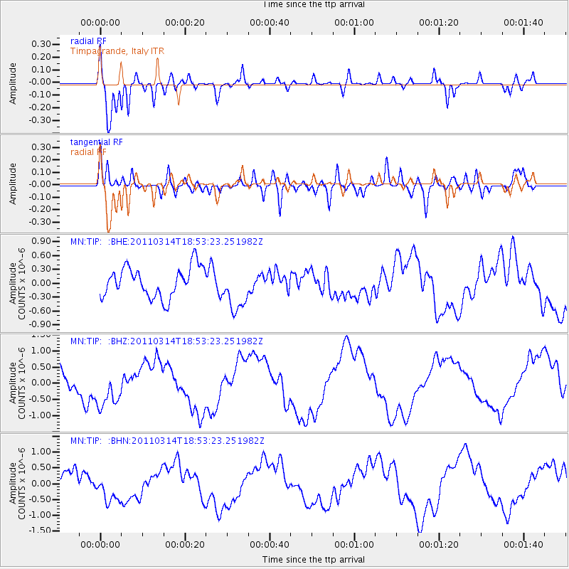
TIP Timpagrande, Italy - Earthquake Result Viewer
*The percent match for this event was below the threshold and hence no stack was calculated.
| Earthquake location: |
Near East Coast Of Honshu, Japan |
| Earthquake latitude/longitude: |
36.6/141.7 |
| Earthquake time(UTC): |
2011/03/14 (073) 18:41:01 GMT |
| Earthquake Depth: |
26 km |
| Earthquake Magnitude: |
5.6 MB, 5.4 MW |
| Earthquake Catalog/Contributor: |
WHDF/NEIC |
|
| Network: |
MN MEDNET Project |
| Station: |
TIP Timpagrande, Italy |
| Lat/Lon: |
39.18 N/16.76 E |
| Elevation: |
789 m |
|
| Distance: |
89.2 deg |
| Az: |
320.443 deg |
| Baz: |
41.267 deg |
| Ray Param: |
$rayparam |
*The percent match for this event was below the threshold and hence was not used in the summary stack. |
|
| Radial Match: |
89.227615 % |
| Radial Bump: |
400 |
| Transverse Match: |
65.13533 % |
| Transverse Bump: |
400 |
| SOD ConfigId: |
356183 |
| Insert Time: |
2011-08-21 00:31:16.309 +0000 |
| GWidth: |
2.5 |
| Max Bumps: |
400 |
| Tol: |
0.001 |
|
Signal To Noise
| Channel | StoN | STA | LTA |
| MN:TIP: :BHZ:20110314T18:53:23.251982Z | 1.3685838 | 6.072193E-7 | 4.4368443E-7 |
| MN:TIP: :BHN:20110314T18:53:23.251982Z | 1.1487615 | 4.4256694E-7 | 3.8525573E-7 |
| MN:TIP: :BHE:20110314T18:53:23.251982Z | 1.5157608 | 4.940586E-7 | 3.259476E-7 |
| Arrivals |
| Ps | |
| PpPs | |
| PsPs/PpSs | |


