You are here: Home > Network List > TA - USArray Transportable Network (new EarthScope stations) Stations List
> Station O38A Galt, MO, USA > Earthquake Result Viewer
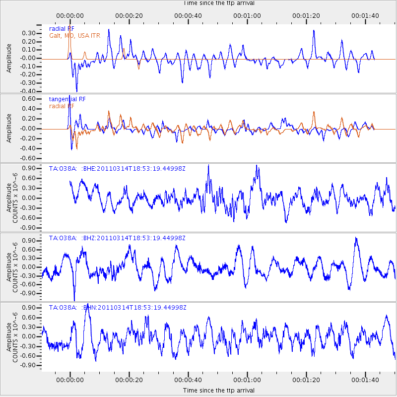
O38A Galt, MO, USA - Earthquake Result Viewer
*The percent match for this event was below the threshold and hence no stack was calculated.
| Earthquake location: |
Near East Coast Of Honshu, Japan |
| Earthquake latitude/longitude: |
36.6/141.7 |
| Earthquake time(UTC): |
2011/03/14 (073) 18:41:01 GMT |
| Earthquake Depth: |
26 km |
| Earthquake Magnitude: |
5.6 MB, 5.4 MW |
| Earthquake Catalog/Contributor: |
WHDF/NEIC |
|
| Network: |
TA USArray Transportable Network (new EarthScope stations) |
| Station: |
O38A Galt, MO, USA |
| Lat/Lon: |
40.12 N/93.47 W |
| Elevation: |
266 m |
|
| Distance: |
88.4 deg |
| Az: |
39.055 deg |
| Baz: |
318.591 deg |
| Ray Param: |
$rayparam |
*The percent match for this event was below the threshold and hence was not used in the summary stack. |
|
| Radial Match: |
61.240707 % |
| Radial Bump: |
400 |
| Transverse Match: |
55.109447 % |
| Transverse Bump: |
400 |
| SOD ConfigId: |
356183 |
| Insert Time: |
2011-08-21 00:46:40.987 +0000 |
| GWidth: |
2.5 |
| Max Bumps: |
400 |
| Tol: |
0.001 |
|
Signal To Noise
| Channel | StoN | STA | LTA |
| TA:O38A: :BHZ:20110314T18:53:19.44998Z | 1.7384754 | 4.5741984E-7 | 2.631155E-7 |
| TA:O38A: :BHN:20110314T18:53:19.44998Z | 1.6133032 | 4.312353E-7 | 2.672996E-7 |
| TA:O38A: :BHE:20110314T18:53:19.44998Z | 0.49436742 | 1.2461908E-7 | 2.5207785E-7 |
| Arrivals |
| Ps | |
| PpPs | |
| PsPs/PpSs | |


