You are here: Home > Network List > US - United States National Seismic Network Stations List
> Station DGMT Dagmar, Montana, USA > Earthquake Result Viewer
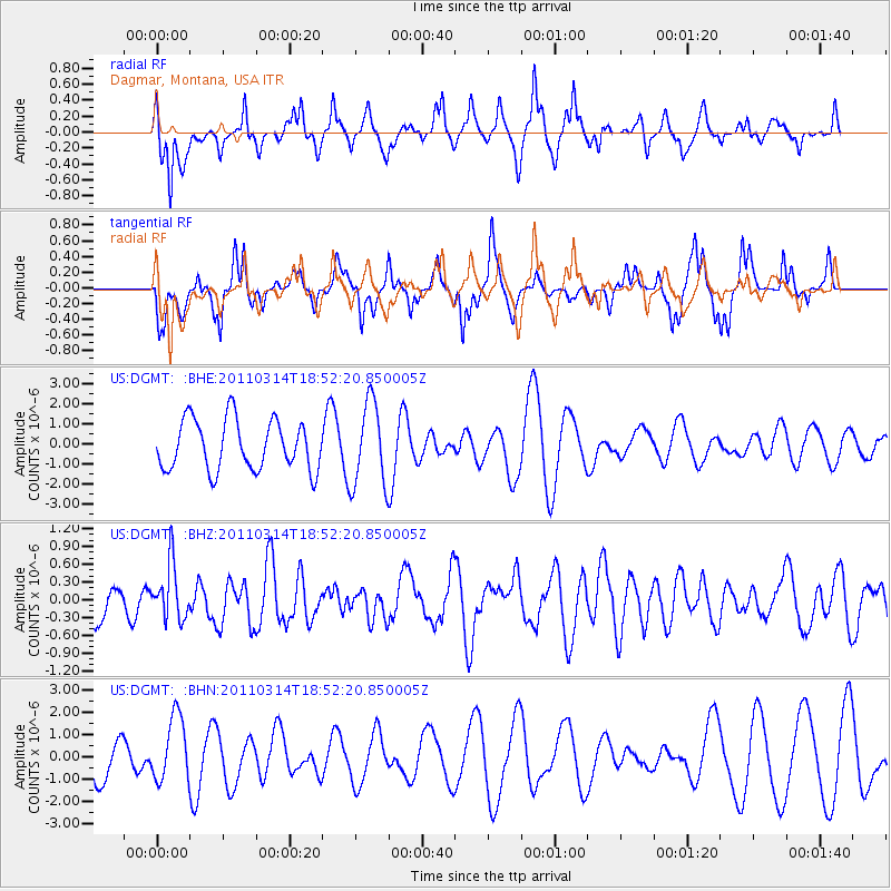
DGMT Dagmar, Montana, USA - Earthquake Result Viewer
*The percent match for this event was below the threshold and hence no stack was calculated.
| Earthquake location: |
Near East Coast Of Honshu, Japan |
| Earthquake latitude/longitude: |
36.6/141.7 |
| Earthquake time(UTC): |
2011/03/14 (073) 18:41:01 GMT |
| Earthquake Depth: |
26 km |
| Earthquake Magnitude: |
5.6 MB, 5.4 MW |
| Earthquake Catalog/Contributor: |
WHDF/NEIC |
|
| Network: |
US United States National Seismic Network |
| Station: |
DGMT Dagmar, Montana, USA |
| Lat/Lon: |
48.47 N/104.20 W |
| Elevation: |
0.0 m |
|
| Distance: |
77.0 deg |
| Az: |
38.579 deg |
| Baz: |
311.037 deg |
| Ray Param: |
$rayparam |
*The percent match for this event was below the threshold and hence was not used in the summary stack. |
|
| Radial Match: |
55.65489 % |
| Radial Bump: |
368 |
| Transverse Match: |
54.62442 % |
| Transverse Bump: |
322 |
| SOD ConfigId: |
356183 |
| Insert Time: |
2011-08-21 00:49:36.589 +0000 |
| GWidth: |
2.5 |
| Max Bumps: |
400 |
| Tol: |
0.001 |
|
Signal To Noise
| Channel | StoN | STA | LTA |
| US:DGMT: :BHZ:20110314T18:52:20.850005Z | 1.5976344 | 4.7313324E-7 | 2.961461E-7 |
| US:DGMT: :BHN:20110314T18:52:20.850005Z | 1.8159362 | 1.4320107E-6 | 7.885798E-7 |
| US:DGMT: :BHE:20110314T18:52:20.850005Z | 1.6850221 | 2.090438E-6 | 1.2405998E-6 |
| Arrivals |
| Ps | |
| PpPs | |
| PsPs/PpSs | |


