You are here: Home > Network List > GE - GEOFON Stations List
> Station UGM GEOFON Station Wanagama, Indonesia > Earthquake Result Viewer
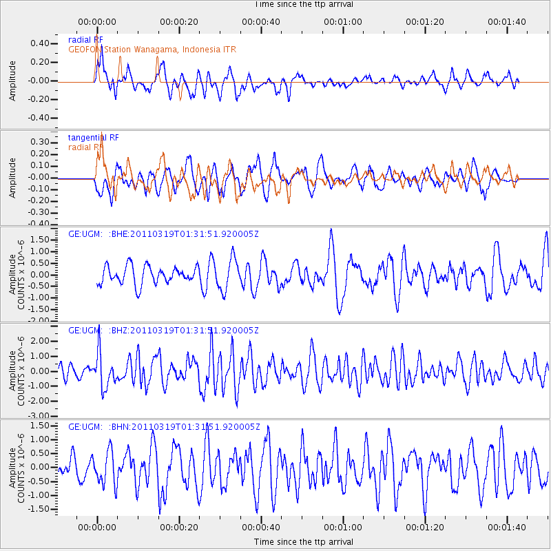
UGM GEOFON Station Wanagama, Indonesia - Earthquake Result Viewer
*The percent match for this event was below the threshold and hence no stack was calculated.
| Earthquake location: |
Near East Coast Of Honshu, Japan |
| Earthquake latitude/longitude: |
39.7/142.9 |
| Earthquake time(UTC): |
2011/03/19 (078) 01:22:44 GMT |
| Earthquake Depth: |
15 km |
| Earthquake Magnitude: |
5.8 MB, 5.6 MS, 5.9 MW, 5.9 MW |
| Earthquake Catalog/Contributor: |
WHDF/NEIC |
|
| Network: |
GE GEOFON |
| Station: |
UGM GEOFON Station Wanagama, Indonesia |
| Lat/Lon: |
7.91 S/110.52 E |
| Elevation: |
350 m |
|
| Distance: |
56.1 deg |
| Az: |
219.757 deg |
| Baz: |
29.875 deg |
| Ray Param: |
$rayparam |
*The percent match for this event was below the threshold and hence was not used in the summary stack. |
|
| Radial Match: |
69.39465 % |
| Radial Bump: |
400 |
| Transverse Match: |
56.578327 % |
| Transverse Bump: |
400 |
| SOD ConfigId: |
356183 |
| Insert Time: |
2011-08-21 02:56:35.127 +0000 |
| GWidth: |
2.5 |
| Max Bumps: |
400 |
| Tol: |
0.001 |
|
Signal To Noise
| Channel | StoN | STA | LTA |
| GE:UGM: :BHZ:20110319T01:31:51.920005Z | 2.446085 | 1.1914036E-6 | 4.8706556E-7 |
| GE:UGM: :BHN:20110319T01:31:51.920005Z | 1.1844255 | 6.0622625E-7 | 5.1183144E-7 |
| GE:UGM: :BHE:20110319T01:31:51.920005Z | 1.8061789 | 6.822726E-7 | 3.7774365E-7 |
| Arrivals |
| Ps | |
| PpPs | |
| PsPs/PpSs | |


