I30A Oacoma, SD, USA - Earthquake Result Viewer
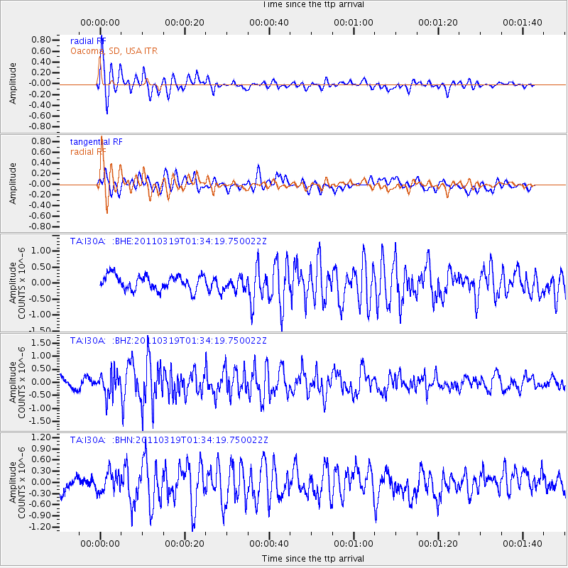
Earthquake location: Near East Coast Of Honshu, Japan
Earthquake latitude/longitude: 39.7/142.9
Earthquake time(UTC): 2011/03/19 (078) 01:22:44 GMT
Earthquake Depth: 15 km
Earthquake Magnitude: 5.8 MB, 5.6 MS, 5.9 MW, 5.9 MW
Earthquake Catalog/Contributor: WHDF/NEIC
Network: TA USArray Transportable Network (new EarthScope stations)
Station: I30A Oacoma, SD, USA
Lat/Lon: 43.91 N/99.43 W
Elevation: 549 m
Distance: 79.6 deg
Az: 40.6 deg
Baz: 315.992 deg
Ray Param: 0.04885034
Estimated Moho Depth: 21.25 km
Estimated Crust Vp/Vs: 1.86
Assumed Crust Vp: 6.53 km/s
Estimated Crust Vs: 3.506 km/s
Estimated Crust Poisson's Ratio: 0.30
Radial Match: 88.40704 %
Radial Bump: 400
Transverse Match: 54.96097 %
Transverse Bump: 400
SOD ConfigId: 356183
Insert Time: 2011-08-21 03:25:05.897 +0000
GWidth: 2.5
Max Bumps: 400
Tol: 0.001

Signal To Noise

ChannelStoNSTALTA
TA:I30A: :BHZ:20110319T01:34:19.750022Z2.26351524.3405612E-71.9176196E-7
TA:I30A: :BHN:20110319T01:34:19.750022Z1.29054192.746504E-72.128179E-7
TA:I30A: :BHE:20110319T01:34:19.750022Z0.848554551.9123826E-72.2536943E-7
Arrivals
Ps2.9 SECOND
PpPs9.1 SECOND
PsPs/PpSs12 SECOND