You are here: Home > Network List > TA - USArray Transportable Network (new EarthScope stations) Stations List
> Station W33A Caddo, Fort Cobb, OK, USA > Earthquake Result Viewer
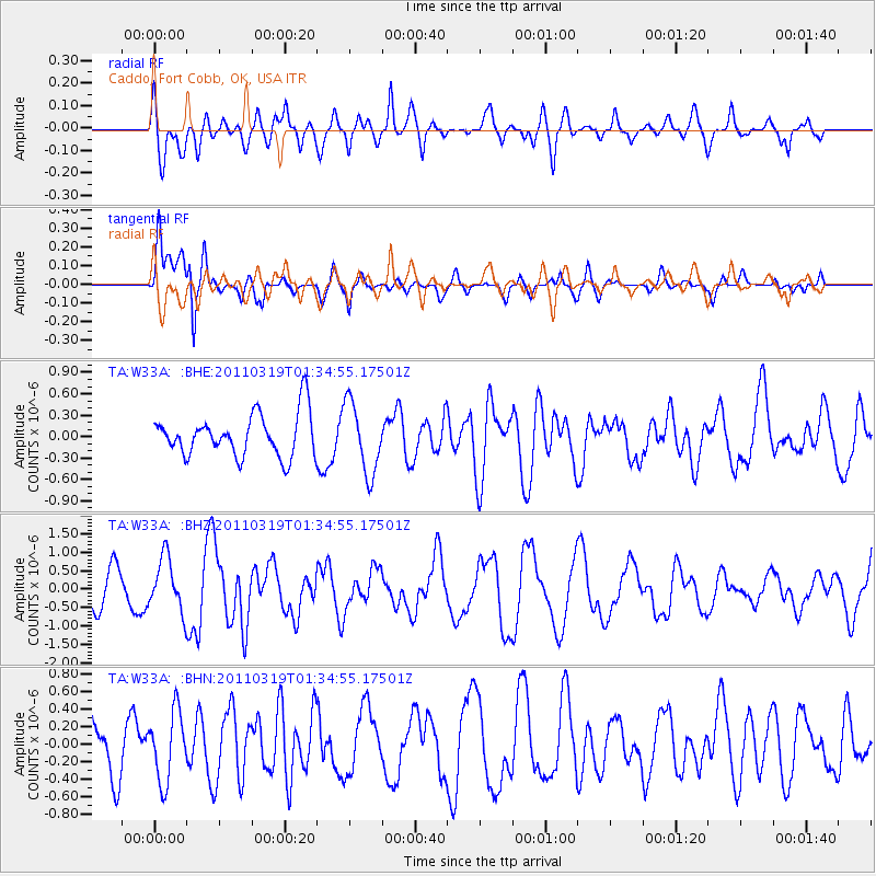
W33A Caddo, Fort Cobb, OK, USA - Earthquake Result Viewer
*The percent match for this event was below the threshold and hence no stack was calculated.
| Earthquake location: |
Near East Coast Of Honshu, Japan |
| Earthquake latitude/longitude: |
39.7/142.9 |
| Earthquake time(UTC): |
2011/03/19 (078) 01:22:44 GMT |
| Earthquake Depth: |
15 km |
| Earthquake Magnitude: |
5.8 MB, 5.6 MS, 5.9 MW, 5.9 MW |
| Earthquake Catalog/Contributor: |
WHDF/NEIC |
|
| Network: |
TA USArray Transportable Network (new EarthScope stations) |
| Station: |
W33A Caddo, Fort Cobb, OK, USA |
| Lat/Lon: |
35.15 N/98.47 W |
| Elevation: |
414 m |
|
| Distance: |
86.5 deg |
| Az: |
46.108 deg |
| Baz: |
317.272 deg |
| Ray Param: |
$rayparam |
*The percent match for this event was below the threshold and hence was not used in the summary stack. |
|
| Radial Match: |
59.14268 % |
| Radial Bump: |
400 |
| Transverse Match: |
68.72258 % |
| Transverse Bump: |
400 |
| SOD ConfigId: |
356183 |
| Insert Time: |
2011-08-21 03:26:34.026 +0000 |
| GWidth: |
2.5 |
| Max Bumps: |
400 |
| Tol: |
0.001 |
|
Signal To Noise
| Channel | StoN | STA | LTA |
| TA:W33A: :BHZ:20110319T01:34:55.17501Z | 1.9435223 | 7.2261304E-7 | 3.7180587E-7 |
| TA:W33A: :BHN:20110319T01:34:55.17501Z | 1.3092735 | 3.9068618E-7 | 2.9839921E-7 |
| TA:W33A: :BHE:20110319T01:34:55.17501Z | 1.6632217 | 4.935639E-7 | 2.9675172E-7 |
| Arrivals |
| Ps | |
| PpPs | |
| PsPs/PpSs | |


