You are here: Home > Network List > TA - USArray Transportable Network (new EarthScope stations) Stations List
> Station 535A Dale, TX, USA > Earthquake Result Viewer
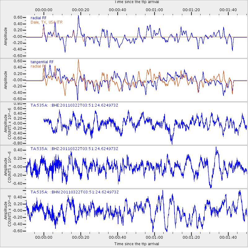
535A Dale, TX, USA - Earthquake Result Viewer
*The percent match for this event was below the threshold and hence no stack was calculated.
| Earthquake location: |
Near East Coast Of Honshu, Japan |
| Earthquake latitude/longitude: |
35.2/141.0 |
| Earthquake time(UTC): |
2011/03/22 (081) 03:38:35 GMT |
| Earthquake Depth: |
20 km |
| Earthquake Magnitude: |
5.5 MB, 5.4 MS, 5.7 MW, 5.6 MW |
| Earthquake Catalog/Contributor: |
WHDF/NEIC |
|
| Network: |
TA USArray Transportable Network (new EarthScope stations) |
| Station: |
535A Dale, TX, USA |
| Lat/Lon: |
30.03 N/97.57 W |
| Elevation: |
170 m |
|
| Distance: |
94.9 deg |
| Az: |
47.956 deg |
| Baz: |
315.472 deg |
| Ray Param: |
$rayparam |
*The percent match for this event was below the threshold and hence was not used in the summary stack. |
|
| Radial Match: |
54.55947 % |
| Radial Bump: |
400 |
| Transverse Match: |
44.74619 % |
| Transverse Bump: |
400 |
| SOD ConfigId: |
356183 |
| Insert Time: |
2011-08-21 04:49:26.584 +0000 |
| GWidth: |
2.5 |
| Max Bumps: |
400 |
| Tol: |
0.001 |
|
Signal To Noise
| Channel | StoN | STA | LTA |
| TA:535A: :BHZ:20110322T03:51:24.624973Z | 1.1812164 | 1.3116022E-7 | 1.11038275E-7 |
| TA:535A: :BHN:20110322T03:51:24.624973Z | 1.0241315 | 1.4423418E-7 | 1.408356E-7 |
| TA:535A: :BHE:20110322T03:51:24.624973Z | 0.53345656 | 1.1469792E-7 | 2.1500892E-7 |
| Arrivals |
| Ps | |
| PpPs | |
| PsPs/PpSs | |


