You are here: Home > Network List > G - GEOSCOPE Stations List
> Station INU Inuyama, Japan > Earthquake Result Viewer
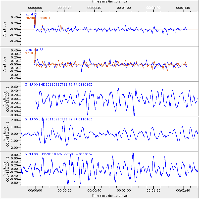
INU Inuyama, Japan - Earthquake Result Viewer
*The percent match for this event was below the threshold and hence no stack was calculated.
| Earthquake location: |
Fiji Islands Region |
| Earthquake latitude/longitude: |
-15.9/-179.4 |
| Earthquake time(UTC): |
2011/03/26 (085) 22:49:41 GMT |
| Earthquake Depth: |
10 km |
| Earthquake Magnitude: |
5.7 MB, 5.9 MS, 6.1 MW, 6.0 MW |
| Earthquake Catalog/Contributor: |
WHDF/NEIC |
|
| Network: |
G GEOSCOPE |
| Station: |
INU Inuyama, Japan |
| Lat/Lon: |
35.35 N/137.03 E |
| Elevation: |
132 m |
|
| Distance: |
65.6 deg |
| Az: |
321.77 deg |
| Baz: |
133.232 deg |
| Ray Param: |
$rayparam |
*The percent match for this event was below the threshold and hence was not used in the summary stack. |
|
| Radial Match: |
75.6314 % |
| Radial Bump: |
398 |
| Transverse Match: |
57.588627 % |
| Transverse Bump: |
343 |
| SOD ConfigId: |
356183 |
| Insert Time: |
2011-08-21 05:22:54.695 +0000 |
| GWidth: |
2.5 |
| Max Bumps: |
400 |
| Tol: |
0.001 |
|
Signal To Noise
| Channel | StoN | STA | LTA |
| G:INU:00:BHZ:20110326T22:59:54.011016Z | 3.8831298 | 6.6253403E-7 | 1.7061856E-7 |
| G:INU:00:BHN:20110326T22:59:54.011016Z | 0.7272254 | 2.239761E-7 | 3.079872E-7 |
| G:INU:00:BHE:20110326T22:59:54.011016Z | 1.0875432 | 2.1729326E-7 | 1.9980196E-7 |
| Arrivals |
| Ps | |
| PpPs | |
| PsPs/PpSs | |


