You are here: Home > Network List > TA - USArray Transportable Network (new EarthScope stations) Stations List
> Station I27A Quinn, SD, USA > Earthquake Result Viewer
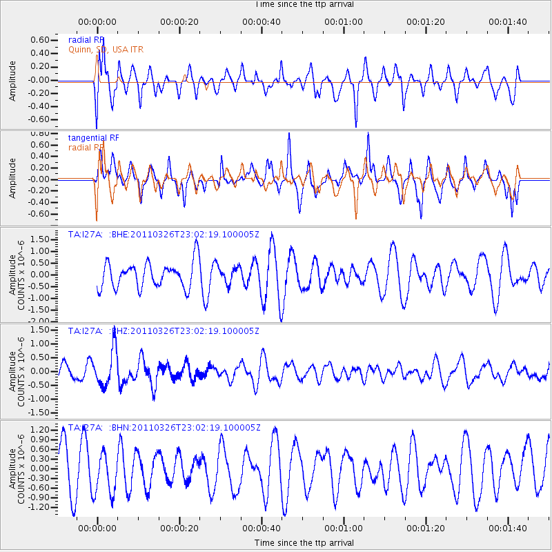
I27A Quinn, SD, USA - Earthquake Result Viewer
*The percent match for this event was below the threshold and hence no stack was calculated.
| Earthquake location: |
Fiji Islands Region |
| Earthquake latitude/longitude: |
-15.9/-179.4 |
| Earthquake time(UTC): |
2011/03/26 (085) 22:49:41 GMT |
| Earthquake Depth: |
10 km |
| Earthquake Magnitude: |
5.7 MB, 5.9 MS, 6.1 MW, 6.0 MW |
| Earthquake Catalog/Contributor: |
WHDF/NEIC |
|
| Network: |
TA USArray Transportable Network (new EarthScope stations) |
| Station: |
I27A Quinn, SD, USA |
| Lat/Lon: |
44.07 N/102.05 W |
| Elevation: |
867 m |
|
| Distance: |
92.1 deg |
| Az: |
44.733 deg |
| Baz: |
250.005 deg |
| Ray Param: |
$rayparam |
*The percent match for this event was below the threshold and hence was not used in the summary stack. |
|
| Radial Match: |
63.013264 % |
| Radial Bump: |
400 |
| Transverse Match: |
48.648605 % |
| Transverse Bump: |
371 |
| SOD ConfigId: |
356183 |
| Insert Time: |
2011-08-21 05:34:44.832 +0000 |
| GWidth: |
2.5 |
| Max Bumps: |
400 |
| Tol: |
0.001 |
|
Signal To Noise
| Channel | StoN | STA | LTA |
| TA:I27A: :BHZ:20110326T23:02:19.100005Z | 2.507848 | 6.6097726E-7 | 2.6356352E-7 |
| TA:I27A: :BHN:20110326T23:02:19.100005Z | 1.0886129 | 6.171376E-7 | 5.6690266E-7 |
| TA:I27A: :BHE:20110326T23:02:19.100005Z | 0.6463596 | 3.5322785E-7 | 5.464881E-7 |
| Arrivals |
| Ps | |
| PpPs | |
| PsPs/PpSs | |


