You are here: Home > Network List > TA - USArray Transportable Network (new EarthScope stations) Stations List
> Station K30A Basset, NE, USA > Earthquake Result Viewer
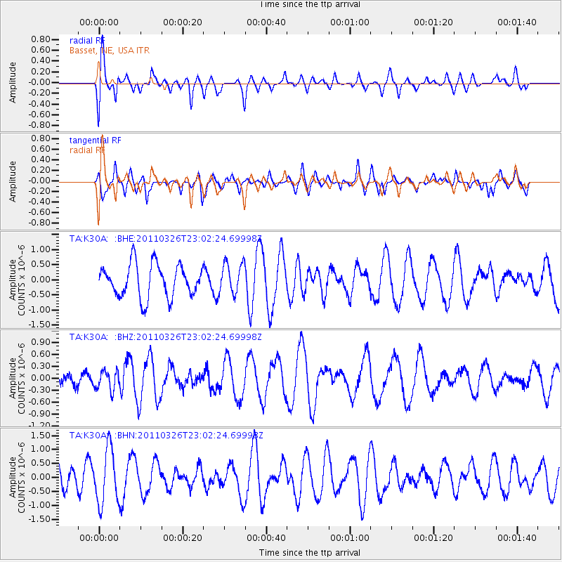
K30A Basset, NE, USA - Earthquake Result Viewer
*The percent match for this event was below the threshold and hence no stack was calculated.
| Earthquake location: |
Fiji Islands Region |
| Earthquake latitude/longitude: |
-15.9/-179.4 |
| Earthquake time(UTC): |
2011/03/26 (085) 22:49:41 GMT |
| Earthquake Depth: |
10 km |
| Earthquake Magnitude: |
5.7 MB, 5.9 MS, 6.1 MW, 6.0 MW |
| Earthquake Catalog/Contributor: |
WHDF/NEIC |
|
| Network: |
TA USArray Transportable Network (new EarthScope stations) |
| Station: |
K30A Basset, NE, USA |
| Lat/Lon: |
42.67 N/99.61 W |
| Elevation: |
712 m |
|
| Distance: |
93.3 deg |
| Az: |
46.637 deg |
| Baz: |
251.585 deg |
| Ray Param: |
$rayparam |
*The percent match for this event was below the threshold and hence was not used in the summary stack. |
|
| Radial Match: |
69.038864 % |
| Radial Bump: |
400 |
| Transverse Match: |
61.314774 % |
| Transverse Bump: |
400 |
| SOD ConfigId: |
356183 |
| Insert Time: |
2011-08-21 05:38:06.175 +0000 |
| GWidth: |
2.5 |
| Max Bumps: |
400 |
| Tol: |
0.001 |
|
Signal To Noise
| Channel | StoN | STA | LTA |
| TA:K30A: :BHZ:20110326T23:02:24.69998Z | 0.52954495 | 2.4571338E-7 | 4.6400856E-7 |
| TA:K30A: :BHN:20110326T23:02:24.69998Z | 2.281414 | 1.007229E-6 | 4.4149328E-7 |
| TA:K30A: :BHE:20110326T23:02:24.69998Z | 0.929981 | 5.034275E-7 | 5.413309E-7 |
| Arrivals |
| Ps | |
| PpPs | |
| PsPs/PpSs | |


