You are here: Home > Network List > G - GEOSCOPE Stations List
> Station TAM Tamanrasset, Algeria > Earthquake Result Viewer
TAM Tamanrasset, Algeria - Earthquake Result Viewer
*The percent match for this event was below the threshold and hence no stack was calculated.
| Earthquake location: |
Near Coast Of Chiapas, Mexico |
| Earthquake latitude/longitude: |
14.4/-92.3 |
| Earthquake time(UTC): |
2011/03/27 (086) 06:20:56 GMT |
| Earthquake Depth: |
35 km |
| Earthquake Magnitude: |
5.7 MW, 5.3 MS, 5.3 MB, 5.7 MW |
| Earthquake Catalog/Contributor: |
WHDF/NEIC |
|
| Network: |
G GEOSCOPE |
| Station: |
TAM Tamanrasset, Algeria |
| Lat/Lon: |
22.79 N/5.53 E |
| Elevation: |
1377 m |
|
| Distance: |
91.6 deg |
| Az: |
66.134 deg |
| Baz: |
286.194 deg |
| Ray Param: |
$rayparam |
*The percent match for this event was below the threshold and hence was not used in the summary stack. |
|
| Radial Match: |
47.820442 % |
| Radial Bump: |
400 |
| Transverse Match: |
47.469982 % |
| Transverse Bump: |
400 |
| SOD ConfigId: |
356183 |
| Insert Time: |
2011-08-21 06:17:17.962 +0000 |
| GWidth: |
2.5 |
| Max Bumps: |
400 |
| Tol: |
0.001 |
|
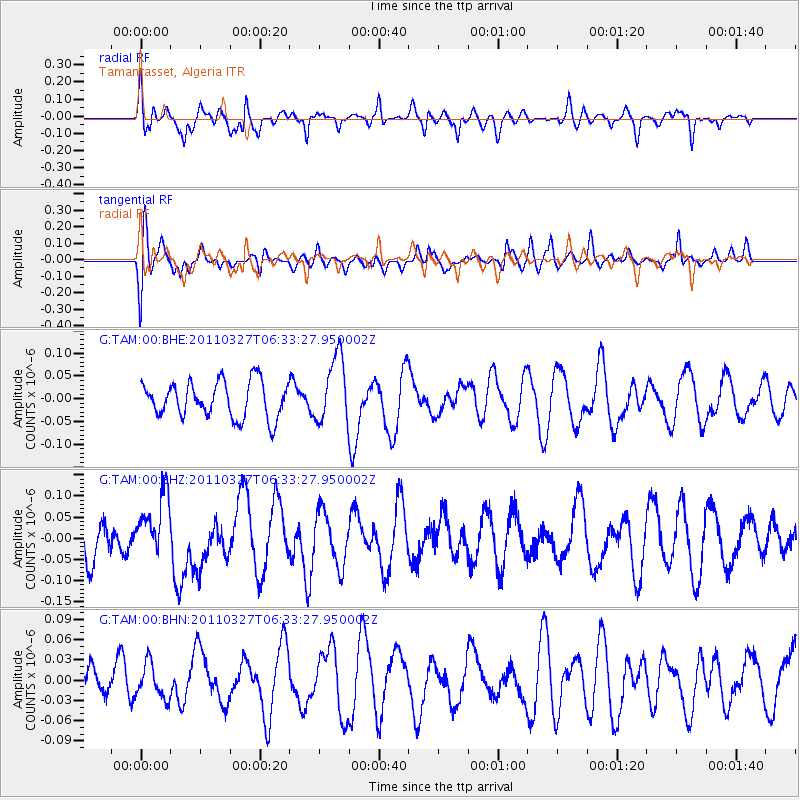
Signal To Noise
| Channel | StoN | STA | LTA |
| G:TAM:00:BHZ:20110327T06:33:27.950002Z | 0.8646334 | 7.634281E-8 | 8.8295E-8 |
| G:TAM:00:BHN:20110327T06:33:27.950002Z | 0.8416237 | 2.5293192E-8 | 3.005285E-8 |
| G:TAM:00:BHE:20110327T06:33:27.950002Z | 1.8493445 | 7.279156E-8 | 3.9360735E-8 |
| Arrivals |
| Ps | |
| PpPs | |
| PsPs/PpSs | |


