You are here: Home > Network List > IW - Intermountain West Stations List
> Station MOOW Moose Ponds, Wyoming, USA > Earthquake Result Viewer
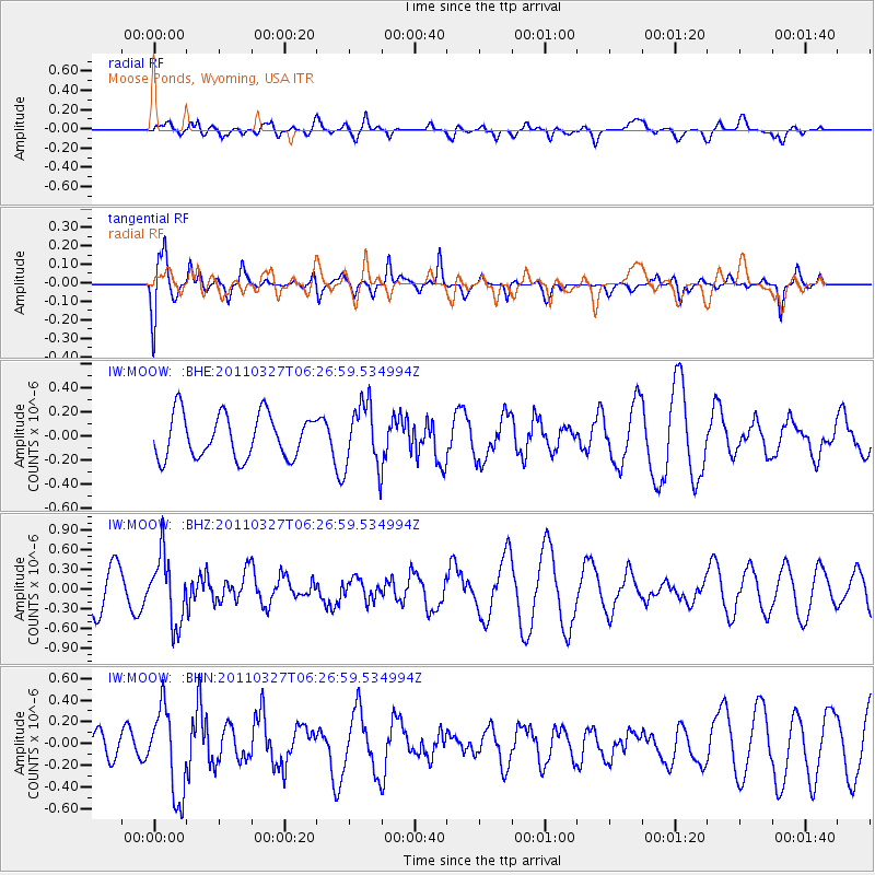
MOOW Moose Ponds, Wyoming, USA - Earthquake Result Viewer
*The percent match for this event was below the threshold and hence no stack was calculated.
| Earthquake location: |
Near Coast Of Chiapas, Mexico |
| Earthquake latitude/longitude: |
14.4/-92.3 |
| Earthquake time(UTC): |
2011/03/27 (086) 06:20:56 GMT |
| Earthquake Depth: |
35 km |
| Earthquake Magnitude: |
5.7 MW, 5.3 MS, 5.3 MB, 5.7 MW |
| Earthquake Catalog/Contributor: |
WHDF/NEIC |
|
| Network: |
IW Intermountain West |
| Station: |
MOOW Moose Ponds, Wyoming, USA |
| Lat/Lon: |
43.75 N/110.74 W |
| Elevation: |
2128 m |
|
| Distance: |
33.2 deg |
| Az: |
335.337 deg |
| Baz: |
146.083 deg |
| Ray Param: |
$rayparam |
*The percent match for this event was below the threshold and hence was not used in the summary stack. |
|
| Radial Match: |
38.768375 % |
| Radial Bump: |
400 |
| Transverse Match: |
50.63818 % |
| Transverse Bump: |
342 |
| SOD ConfigId: |
356183 |
| Insert Time: |
2011-08-21 06:24:18.262 +0000 |
| GWidth: |
2.5 |
| Max Bumps: |
400 |
| Tol: |
0.001 |
|
Signal To Noise
| Channel | StoN | STA | LTA |
| IW:MOOW: :BHZ:20110327T06:26:59.534994Z | 1.8285881 | 5.1437854E-7 | 2.812982E-7 |
| IW:MOOW: :BHN:20110327T06:26:59.534994Z | 4.4196696 | 4.0060075E-7 | 9.0640434E-8 |
| IW:MOOW: :BHE:20110327T06:26:59.534994Z | 1.4779783 | 2.703505E-7 | 1.8291911E-7 |
| Arrivals |
| Ps | |
| PpPs | |
| PsPs/PpSs | |


