You are here: Home > Network List > TA - USArray Transportable Network (new EarthScope stations) Stations List
> Station MDND Maddock, ND, USA > Earthquake Result Viewer
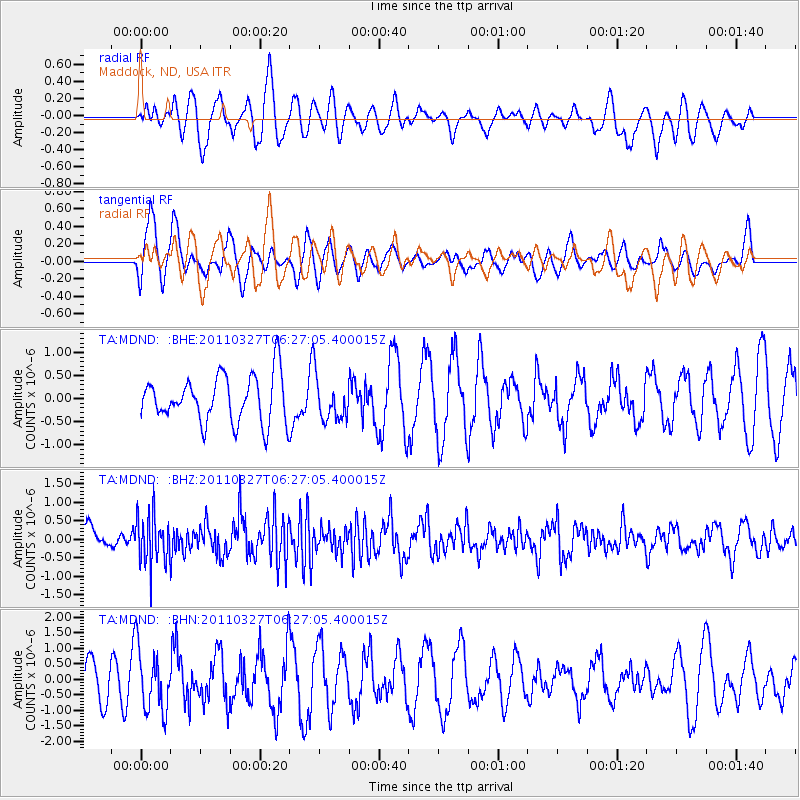
MDND Maddock, ND, USA - Earthquake Result Viewer
*The percent match for this event was below the threshold and hence no stack was calculated.
| Earthquake location: |
Near Coast Of Chiapas, Mexico |
| Earthquake latitude/longitude: |
14.4/-92.3 |
| Earthquake time(UTC): |
2011/03/27 (086) 06:20:56 GMT |
| Earthquake Depth: |
35 km |
| Earthquake Magnitude: |
5.7 MW, 5.3 MS, 5.3 MB, 5.7 MW |
| Earthquake Catalog/Contributor: |
WHDF/NEIC |
|
| Network: |
TA USArray Transportable Network (new EarthScope stations) |
| Station: |
MDND Maddock, ND, USA |
| Lat/Lon: |
47.85 N/99.60 W |
| Elevation: |
479 m |
|
| Distance: |
33.9 deg |
| Az: |
351.23 deg |
| Baz: |
167.328 deg |
| Ray Param: |
$rayparam |
*The percent match for this event was below the threshold and hence was not used in the summary stack. |
|
| Radial Match: |
47.302353 % |
| Radial Bump: |
400 |
| Transverse Match: |
68.8542 % |
| Transverse Bump: |
400 |
| SOD ConfigId: |
356183 |
| Insert Time: |
2011-08-21 06:29:03.613 +0000 |
| GWidth: |
2.5 |
| Max Bumps: |
400 |
| Tol: |
0.001 |
|
Signal To Noise
| Channel | StoN | STA | LTA |
| TA:MDND: :BHZ:20110327T06:27:05.400015Z | 2.305532 | 6.5982414E-7 | 2.8619172E-7 |
| TA:MDND: :BHN:20110327T06:27:05.400015Z | 1.3213118 | 9.933486E-7 | 7.517897E-7 |
| TA:MDND: :BHE:20110327T06:27:05.400015Z | 0.89276093 | 4.5137475E-7 | 5.055942E-7 |
| Arrivals |
| Ps | |
| PpPs | |
| PsPs/PpSs | |


