You are here: Home > Network List > US - United States National Seismic Network Stations List
> Station HAWA Hanford, Washington, USA > Earthquake Result Viewer
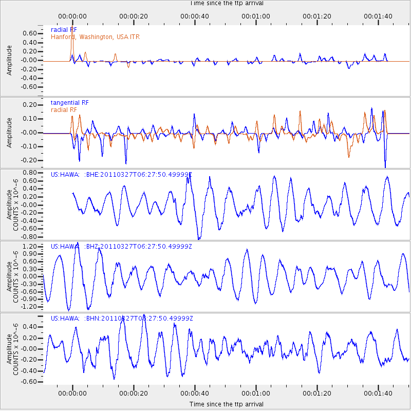
HAWA Hanford, Washington, USA - Earthquake Result Viewer
*The percent match for this event was below the threshold and hence no stack was calculated.
| Earthquake location: |
Near Coast Of Chiapas, Mexico |
| Earthquake latitude/longitude: |
14.4/-92.3 |
| Earthquake time(UTC): |
2011/03/27 (086) 06:20:56 GMT |
| Earthquake Depth: |
35 km |
| Earthquake Magnitude: |
5.7 MW, 5.3 MS, 5.3 MB, 5.7 MW |
| Earthquake Catalog/Contributor: |
WHDF/NEIC |
|
| Network: |
US United States National Seismic Network |
| Station: |
HAWA Hanford, Washington, USA |
| Lat/Lon: |
46.39 N/119.53 W |
| Elevation: |
364 m |
|
| Distance: |
39.2 deg |
| Az: |
329.994 deg |
| Baz: |
135.557 deg |
| Ray Param: |
$rayparam |
*The percent match for this event was below the threshold and hence was not used in the summary stack. |
|
| Radial Match: |
36.46719 % |
| Radial Bump: |
400 |
| Transverse Match: |
75.32262 % |
| Transverse Bump: |
400 |
| SOD ConfigId: |
356183 |
| Insert Time: |
2011-08-21 06:45:22.151 +0000 |
| GWidth: |
2.5 |
| Max Bumps: |
400 |
| Tol: |
0.001 |
|
Signal To Noise
| Channel | StoN | STA | LTA |
| US:HAWA: :BHZ:20110327T06:27:50.49999Z | 1.8671758 | 8.57461E-7 | 4.5922886E-7 |
| US:HAWA: :BHN:20110327T06:27:50.49999Z | 0.8535097 | 2.3025869E-7 | 2.6977864E-7 |
| US:HAWA: :BHE:20110327T06:27:50.49999Z | 1.0345793 | 2.3048234E-7 | 2.2277881E-7 |
| Arrivals |
| Ps | |
| PpPs | |
| PsPs/PpSs | |


