You are here: Home > Network List > UW - Pacific Northwest Regional Seismic Network Stations List
> Station HOOD Mt Hood Meadows, OR CREST BB SMO > Earthquake Result Viewer
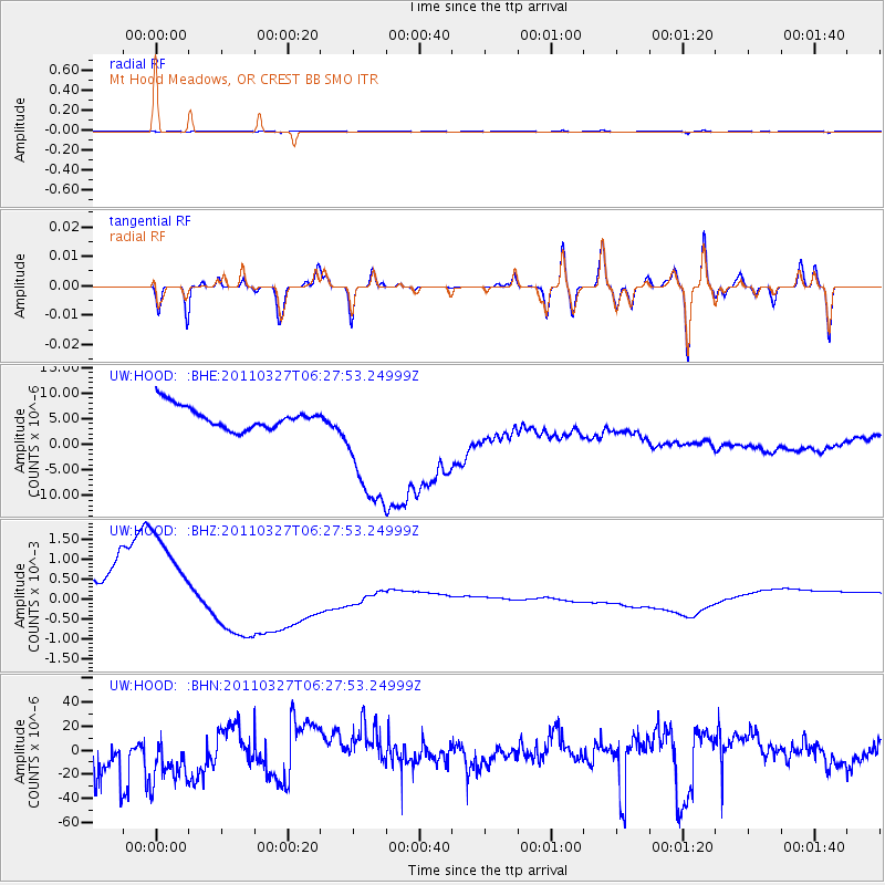
HOOD Mt Hood Meadows, OR CREST BB SMO - Earthquake Result Viewer
*The percent match for this event was below the threshold and hence no stack was calculated.
| Earthquake location: |
Near Coast Of Chiapas, Mexico |
| Earthquake latitude/longitude: |
14.4/-92.3 |
| Earthquake time(UTC): |
2011/03/27 (086) 06:20:56 GMT |
| Earthquake Depth: |
35 km |
| Earthquake Magnitude: |
5.7 MW, 5.3 MS, 5.3 MB, 5.7 MW |
| Earthquake Catalog/Contributor: |
WHDF/NEIC |
|
| Network: |
UW Pacific Northwest Regional Seismic Network |
| Station: |
HOOD Mt Hood Meadows, OR CREST BB SMO |
| Lat/Lon: |
45.32 N/121.65 W |
| Elevation: |
1520 m |
|
| Distance: |
39.6 deg |
| Az: |
327.16 deg |
| Baz: |
131.849 deg |
| Ray Param: |
$rayparam |
*The percent match for this event was below the threshold and hence was not used in the summary stack. |
|
| Radial Match: |
42.78607 % |
| Radial Bump: |
400 |
| Transverse Match: |
51.45948 % |
| Transverse Bump: |
400 |
| SOD ConfigId: |
356183 |
| Insert Time: |
2011-08-21 06:47:28.514 +0000 |
| GWidth: |
2.5 |
| Max Bumps: |
400 |
| Tol: |
0.001 |
|
Signal To Noise
| Channel | StoN | STA | LTA |
| UW:HOOD: :BHZ:20110327T06:27:53.24999Z | 2.5713274 | 0.0014232133 | 5.5349356E-4 |
| UW:HOOD: :BHN:20110327T06:27:53.24999Z | 0.8172795 | 2.4155936E-5 | 2.9556517E-5 |
| UW:HOOD: :BHE:20110327T06:27:53.24999Z | 6.1260595 | 1.3297078E-5 | 2.170576E-6 |
| Arrivals |
| Ps | |
| PpPs | |
| PsPs/PpSs | |


