You are here: Home > Network List > TA - USArray Transportable Network (new EarthScope stations) Stations List
> Station X37A Clayton, OK, USA > Earthquake Result Viewer
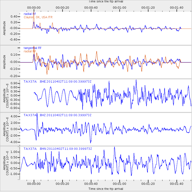
X37A Clayton, OK, USA - Earthquake Result Viewer
*The percent match for this event was below the threshold and hence no stack was calculated.
| Earthquake location: |
Northern Chile |
| Earthquake latitude/longitude: |
-19.6/-69.1 |
| Earthquake time(UTC): |
2011/04/02 (092) 10:59:37 GMT |
| Earthquake Depth: |
84 km |
| Earthquake Magnitude: |
6.0 MB, 5.9 MW, 5.9 MW |
| Earthquake Catalog/Contributor: |
WHDF/NEIC |
|
| Network: |
TA USArray Transportable Network (new EarthScope stations) |
| Station: |
X37A Clayton, OK, USA |
| Lat/Lon: |
34.59 N/95.37 W |
| Elevation: |
207 m |
|
| Distance: |
59.4 deg |
| Az: |
334.862 deg |
| Baz: |
150.954 deg |
| Ray Param: |
$rayparam |
*The percent match for this event was below the threshold and hence was not used in the summary stack. |
|
| Radial Match: |
48.2315 % |
| Radial Bump: |
400 |
| Transverse Match: |
59.180332 % |
| Transverse Bump: |
400 |
| SOD ConfigId: |
356183 |
| Insert Time: |
2011-09-23 09:41:37.489 +0000 |
| GWidth: |
2.5 |
| Max Bumps: |
400 |
| Tol: |
0.001 |
|
Signal To Noise
| Channel | StoN | STA | LTA |
| TA:X37A: :BHZ:20110402T11:09:00.399973Z | 3.4357097 | 1.7958341E-6 | 5.226967E-7 |
| TA:X37A: :BHN:20110402T11:09:00.399973Z | 0.87178284 | 3.562538E-7 | 4.086497E-7 |
| TA:X37A: :BHE:20110402T11:09:00.399973Z | 0.88112676 | 3.165122E-7 | 3.5921303E-7 |
| Arrivals |
| Ps | |
| PpPs | |
| PsPs/PpSs | |


