You are here: Home > Network List > TA - USArray Transportable Network (new EarthScope stations) Stations List
> Station G35A Watkins, MN, USA > Earthquake Result Viewer
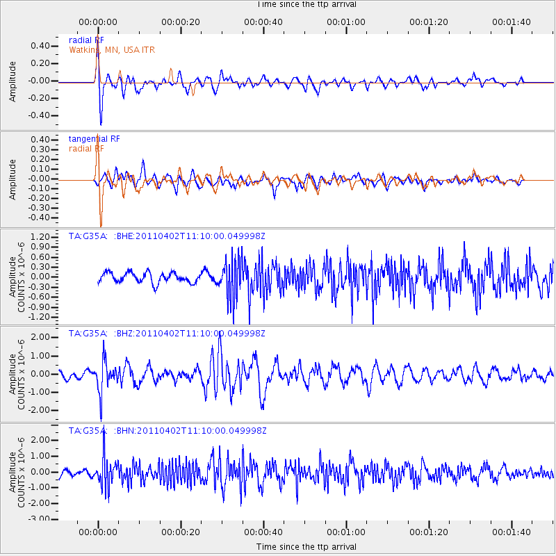
G35A Watkins, MN, USA - Earthquake Result Viewer
*The percent match for this event was below the threshold and hence no stack was calculated.
| Earthquake location: |
Northern Chile |
| Earthquake latitude/longitude: |
-19.6/-69.1 |
| Earthquake time(UTC): |
2011/04/02 (092) 10:59:37 GMT |
| Earthquake Depth: |
84 km |
| Earthquake Magnitude: |
6.0 MB, 5.9 MW, 5.9 MW |
| Earthquake Catalog/Contributor: |
WHDF/NEIC |
|
| Network: |
TA USArray Transportable Network (new EarthScope stations) |
| Station: |
G35A Watkins, MN, USA |
| Lat/Lon: |
45.22 N/94.49 W |
| Elevation: |
361 m |
|
| Distance: |
68.5 deg |
| Az: |
340.971 deg |
| Baz: |
154.216 deg |
| Ray Param: |
$rayparam |
*The percent match for this event was below the threshold and hence was not used in the summary stack. |
|
| Radial Match: |
55.83622 % |
| Radial Bump: |
400 |
| Transverse Match: |
51.718643 % |
| Transverse Bump: |
400 |
| SOD ConfigId: |
356183 |
| Insert Time: |
2011-09-23 10:11:10.214 +0000 |
| GWidth: |
2.5 |
| Max Bumps: |
400 |
| Tol: |
0.001 |
|
Signal To Noise
| Channel | StoN | STA | LTA |
| TA:G35A: :BHZ:20110402T11:10:00.049998Z | 3.6705043 | 8.281364E-7 | 2.2561925E-7 |
| TA:G35A: :BHN:20110402T11:10:00.049998Z | 3.8231287 | 8.944487E-7 | 2.3395725E-7 |
| TA:G35A: :BHE:20110402T11:10:00.049998Z | 3.8712351 | 5.779688E-7 | 1.492983E-7 |
| Arrivals |
| Ps | |
| PpPs | |
| PsPs/PpSs | |


