
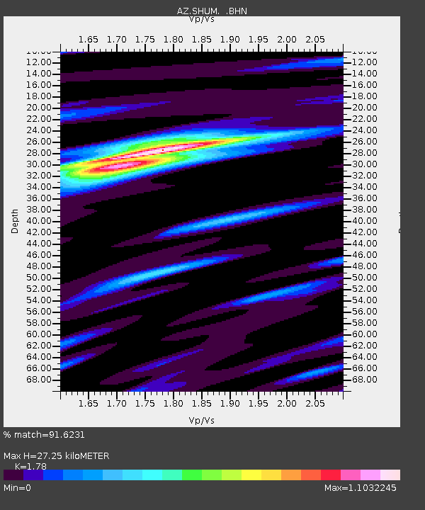
SHUM AZ.SHUM - Earthquake Result Viewer
| ||||||||||||||||||
| ||||||||||||||||||
| ||||||||||||||||||
|
Signal To Noise
| Channel | StoN | STA | LTA |
| AZ:SHUM: :BHN:19961106T20:12:50.625012Z | 0.56614023 | 1.4430859E-7 | 2.5489902E-7 |
| AZ:SHUM: :BHE:19961106T20:12:50.625012Z | 1.5229901 | 2.9178923E-7 | 1.915897E-7 |
| AZ:SHUM: :BHZ:19961106T20:12:50.625012Z | 2.1909544 | 7.8923205E-7 | 3.6022294E-7 |
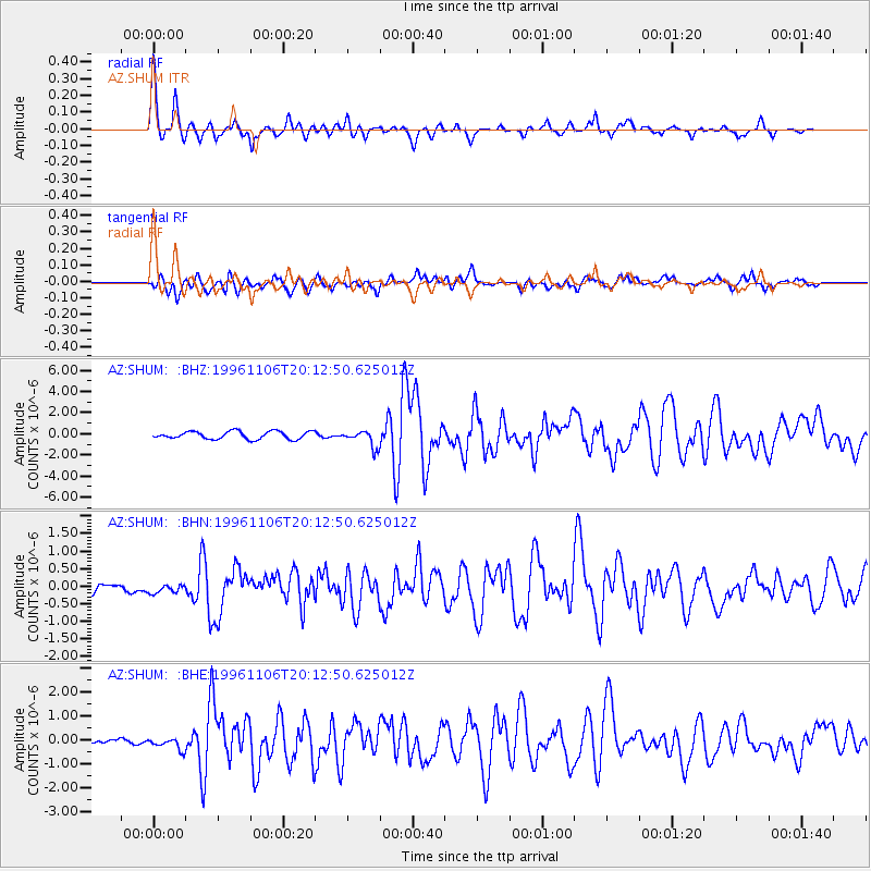
| Arrivals | |
| Ps | 3.5 SECOND |
| PpPs | 12 SECOND |
| PsPs/PpSs | 15 SECOND |

