
SHUM AZ.SHUM - Earthquake Result Viewer
| ||||||||||||||||||
| ||||||||||||||||||
| ||||||||||||||||||
|
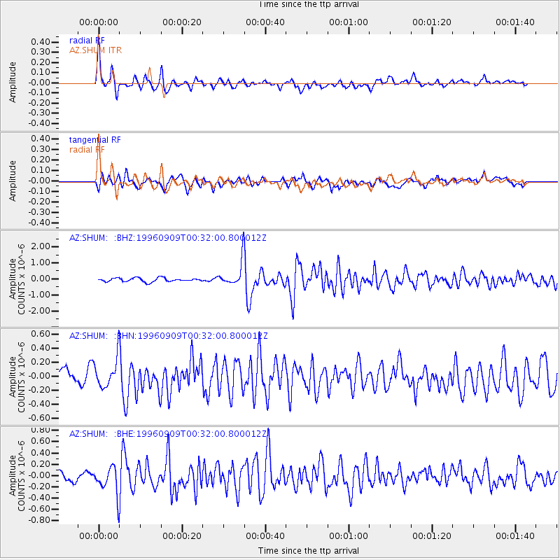
Signal To Noise
| Channel | StoN | STA | LTA |
| AZ:SHUM: :BHN:19960909T00:32:00.800012Z | 2.7801406 | 2.0426181E-7 | 7.347175E-8 |
| AZ:SHUM: :BHE:19960909T00:32:00.800012Z | 3.1070013 | 2.488675E-7 | 8.009894E-8 |
| AZ:SHUM: :BHZ:19960909T00:32:00.800012Z | 7.2051373 | 8.38118E-7 | 1.1632228E-7 |
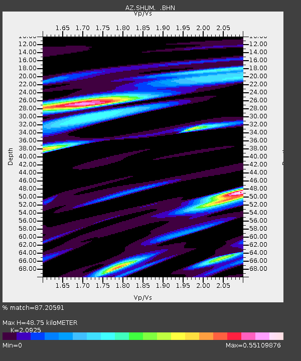
| Arrivals | |
| Ps | 8.7 SECOND |
| PpPs | 23 SECOND |
| PsPs/PpSs | 32 SECOND |

