
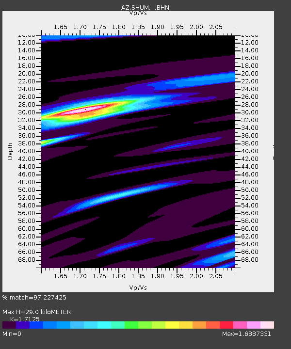
SHUM AZ.SHUM - Earthquake Result Viewer
| ||||||||||||||||||
| ||||||||||||||||||
| ||||||||||||||||||
|
Signal To Noise
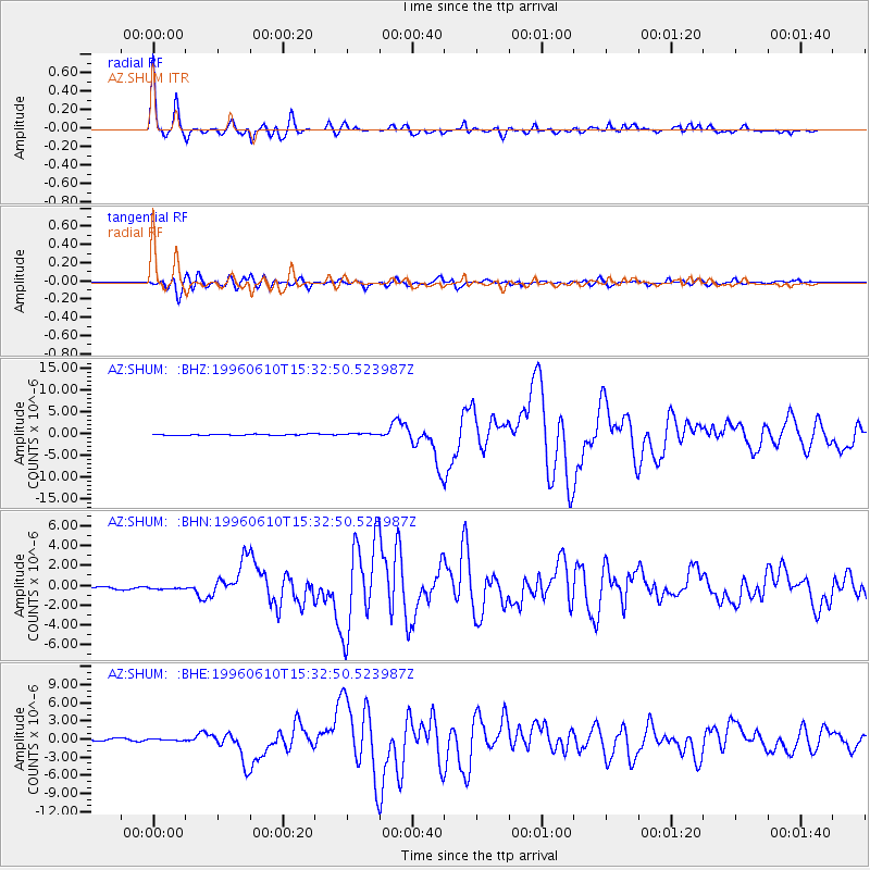
| Channel | StoN | STA | LTA |
| AZ:SHUM: :BHN:19960610T15:32:50.523987Z | 1.1957471 | 2.1159315E-7 | 1.7695476E-7 |
| AZ:SHUM: :BHE:19960610T15:32:50.523987Z | 0.5106817 | 9.9817804E-8 | 1.9545993E-7 |
| AZ:SHUM: :BHZ:19960610T15:32:50.523987Z | 1.7837796 | 2.2167158E-7 | 1.2427073E-7 |
| Arrivals | |
| Ps | 3.5 SECOND |
| PpPs | 12 SECOND |
| PsPs/PpSs | 15 SECOND |

