SHUM AZ.SHUM - Earthquake Result Viewer
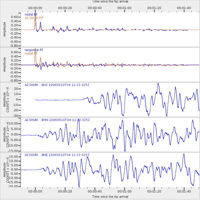
Earthquake location: Andreanof Islands, Aleutian Is.
Earthquake latitude/longitude: 51.6/-177.6
Earthquake time(UTC): 1996/06/10 (162) 04:03:35 GMT
Earthquake Depth: 33 km
Earthquake Magnitude: 6.6 MB, 7.6 MS, 7.9 UNKNOWN, 7.4 MS
Earthquake Catalog/Contributor: WHDF/NEIC
Network: AZ ANZA Regional Network
Station: SHUM AZ.SHUM
Lat/Lon: 33.63 N/116.44 W
Elevation: 1195 m
Distance: 47.0 deg
Az: 87.652 deg
Baz: 311.623 deg
Ray Param: 0.07019829
Estimated Moho Depth: 30.0 km
Estimated Crust Vp/Vs: 1.69
Assumed Crust Vp: 6.264 km/s
Estimated Crust Vs: 3.717 km/s
Estimated Crust Poisson's Ratio: 0.23
Radial Match: 96.556465 %
Radial Bump: 215
Transverse Match: 86.671005 %
Transverse Bump: 400
SOD ConfigId: 6273
Insert Time: 2010-02-26 20:40:43.745 +0000
GWidth: 2.5
Max Bumps: 400
Tol: 0.001

Signal To Noise

ChannelStoNSTALTA
AZ:SHUM: :BHN:19960610T04:11:33.025Z4.0813067.554759E-71.851064E-7
AZ:SHUM: :BHE:19960610T04:11:33.025Z5.38933047.2873183E-71.352175E-7
AZ:SHUM: :BHZ:19960610T04:11:33.025Z12.5305731.9305062E-61.540637E-7
Arrivals
Ps3.5 SECOND
PpPs12 SECOND
PsPs/PpSs16 SECOND