You are here: Home > Network List > TA - USArray Transportable Network (new EarthScope stations) Stations List
> Station 121A Cookes Peak, Deming, NM, USA > Earthquake Result Viewer
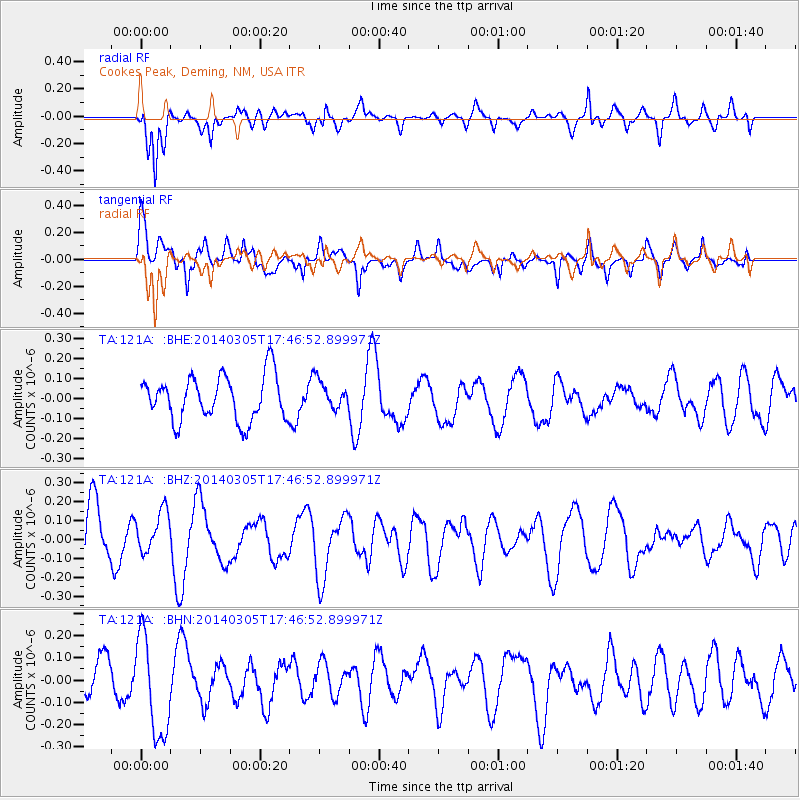
121A Cookes Peak, Deming, NM, USA - Earthquake Result Viewer
*The percent match for this event was below the threshold and hence no stack was calculated.
| Earthquake location: |
Vanuatu Islands |
| Earthquake latitude/longitude: |
-14.8/167.2 |
| Earthquake time(UTC): |
2014/03/05 (064) 17:34:19 GMT |
| Earthquake Depth: |
108 km |
| Earthquake Magnitude: |
5.5 MW |
| Earthquake Catalog/Contributor: |
ISC/ISC |
|
| Network: |
TA USArray Transportable Network (new EarthScope stations) |
| Station: |
121A Cookes Peak, Deming, NM, USA |
| Lat/Lon: |
32.53 N/107.79 W |
| Elevation: |
1652 m |
|
| Distance: |
93.7 deg |
| Az: |
57.487 deg |
| Baz: |
254.901 deg |
| Ray Param: |
$rayparam |
*The percent match for this event was below the threshold and hence was not used in the summary stack. |
|
| Radial Match: |
74.57716 % |
| Radial Bump: |
400 |
| Transverse Match: |
67.94321 % |
| Transverse Bump: |
400 |
| SOD ConfigId: |
3390531 |
| Insert Time: |
2019-04-10 12:45:41.762 +0000 |
| GWidth: |
2.5 |
| Max Bumps: |
400 |
| Tol: |
0.001 |
|
Signal To Noise
| Channel | StoN | STA | LTA |
| TA:121A: :BHZ:20140305T17:46:52.899971Z | 0.6494136 | 1.1013163E-7 | 1.6958627E-7 |
| TA:121A: :BHN:20140305T17:46:52.899971Z | 2.2397084 | 2.2890175E-7 | 1.0220158E-7 |
| TA:121A: :BHE:20140305T17:46:52.899971Z | 0.6360406 | 7.022869E-8 | 1.1041541E-7 |
| Arrivals |
| Ps | |
| PpPs | |
| PsPs/PpSs | |


