You are here: Home > Network List > TA - USArray Transportable Network (new EarthScope stations) Stations List
> Station T25A Trinidad, CO, USA > Earthquake Result Viewer
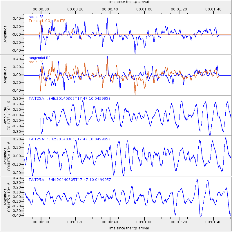
T25A Trinidad, CO, USA - Earthquake Result Viewer
*The percent match for this event was below the threshold and hence no stack was calculated.
| Earthquake location: |
Vanuatu Islands |
| Earthquake latitude/longitude: |
-14.8/167.2 |
| Earthquake time(UTC): |
2014/03/05 (064) 17:34:19 GMT |
| Earthquake Depth: |
108 km |
| Earthquake Magnitude: |
5.5 MW |
| Earthquake Catalog/Contributor: |
ISC/ISC |
|
| Network: |
TA USArray Transportable Network (new EarthScope stations) |
| Station: |
T25A Trinidad, CO, USA |
| Lat/Lon: |
37.14 N/104.41 W |
| Elevation: |
2017 m |
|
| Distance: |
97.5 deg |
| Az: |
53.681 deg |
| Baz: |
257.195 deg |
| Ray Param: |
$rayparam |
*The percent match for this event was below the threshold and hence was not used in the summary stack. |
|
| Radial Match: |
56.956097 % |
| Radial Bump: |
400 |
| Transverse Match: |
47.433815 % |
| Transverse Bump: |
373 |
| SOD ConfigId: |
3390531 |
| Insert Time: |
2019-04-10 12:45:48.627 +0000 |
| GWidth: |
2.5 |
| Max Bumps: |
400 |
| Tol: |
0.001 |
|
Signal To Noise
| Channel | StoN | STA | LTA |
| TA:T25A: :BHZ:20140305T17:47:10.049995Z | 0.7976238 | 6.214556E-8 | 7.791337E-8 |
| TA:T25A: :BHN:20140305T17:47:10.049995Z | 0.7512993 | 8.767356E-8 | 1.1669592E-7 |
| TA:T25A: :BHE:20140305T17:47:10.049995Z | 0.7716269 | 1.00286606E-7 | 1.2996775E-7 |
| Arrivals |
| Ps | |
| PpPs | |
| PsPs/PpSs | |


